Unsettled Weather to Continue Across Tenerife
Meteorologist Jorge Rey has issued a new weather forecast that brings little cheer for Tenerife. Following Storm Emilia, the archipelago will face further rainfall this week, ahead of a major weather front set to affect the whole of Spain just before Christmas, marking the festive period with poor conditions.
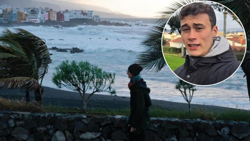
Atlantic Fronts Bring Wind and Showers
The young forecaster warns of persistent winds and the staggered arrival of Atlantic fronts that will also bring rain to the islands, particularly around mid-week. His prediction suggests the Canaries face a week marked by atmospheric instability, though far from the more extreme episodes expected across much of the Spanish mainland. According to Rey, the islands will remain under the influence of successive Atlantic depressions: “The wind will continue to be strong these days in the west and the Canaries.”
He insists that while the rainfall will not be especially heavy, it will recur at various points during the week. The general outlook points to light or locally moderate rain, with a slight uptick expected on Wednesday. The forecast for the Canaries does not currently anticipate widespread warnings for adverse phenomena, but rather a disturbed atmosphere. Despite this, Jorge Rey qualifies that “on Wednesday, instability seems to increase a bit more, but generally very little.” These showers will be associated with the passage of weak fronts, more noticeable on the northern slopes of the more mountainous islands.
Wind and Swell Expected for Western Islands
Wind will be another key feature, especially in exposed areas and the western islands. The succession of Atlantic lows will maintain an unstable airflow which, without generating major storms in the islands, will contribute to an increase in swell along some coasts.
Major Storm Set to Batter Mainland Spain
While the Canaries experience a calmer episode, the picture for the rest of Spain will be far more complicated. Jorge Rey warns of a “tremendous storm arriving in Spain next week,” with significant rainfall accumulations and a notable drop in temperatures. Warnings from the State Meteorological Agency (AEMET) are concentrated in the Mediterranean, with red and orange alerts for severe thunderstorms.
“On Monday another front arrives, with new rain and notable accumulations across the entire Iberian Peninsula, also over the Canaries in the coming days,” Rey states, clarifying that the greatest impact will be on the mainland. As the week progresses, polar air will gain prominence, opening the door to snowfall in mountainous areas and even in inland cities such as Ávila or Segovia.
Canaries a Contrast to Wintry Peninsula
Looking ahead to the days before Christmas, the meteorologist points to a clearly wintry scenario on the Peninsula, with more extensive snowfall and intense winds, with “a storm that will arrive deepening with polar air,” which could mark the start of a very active period meteorologically. In the Canaries, the impact of this pattern will be more moderate, with intermittent rain, wind, and cooler conditions than usual, but far from extreme episodes. A clear contrast that once again positions the islands as an exception within a meteorological map dominated by instability in the rest of Spain.
No post found!