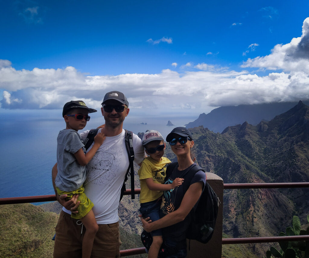
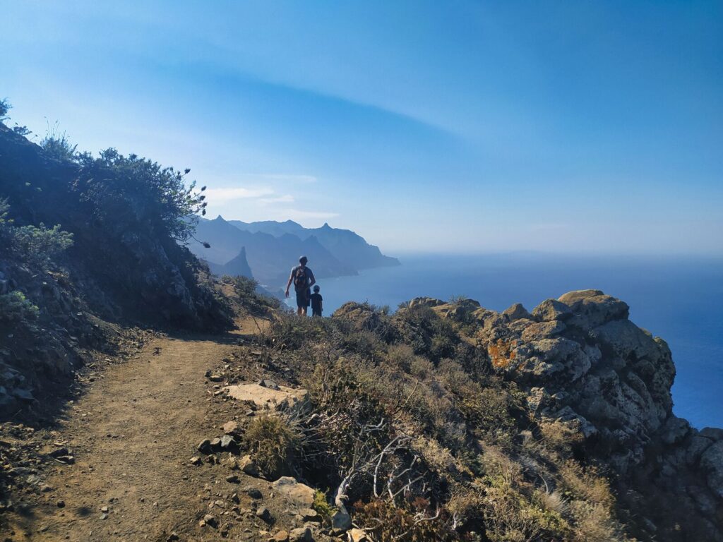
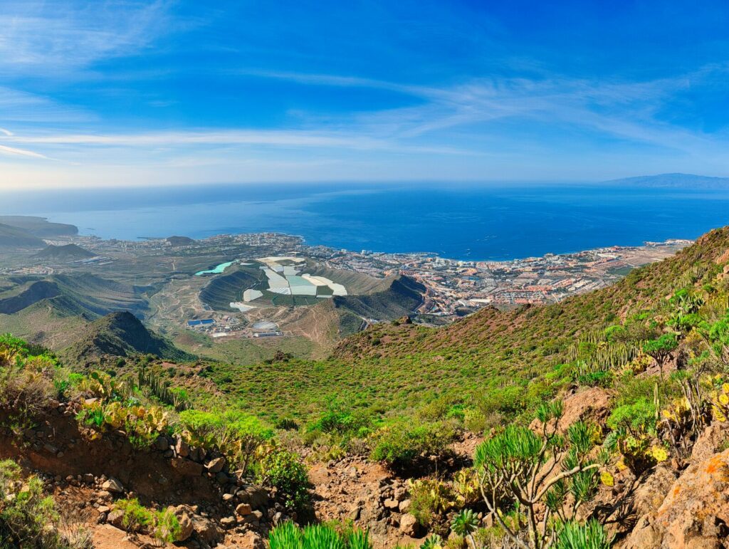
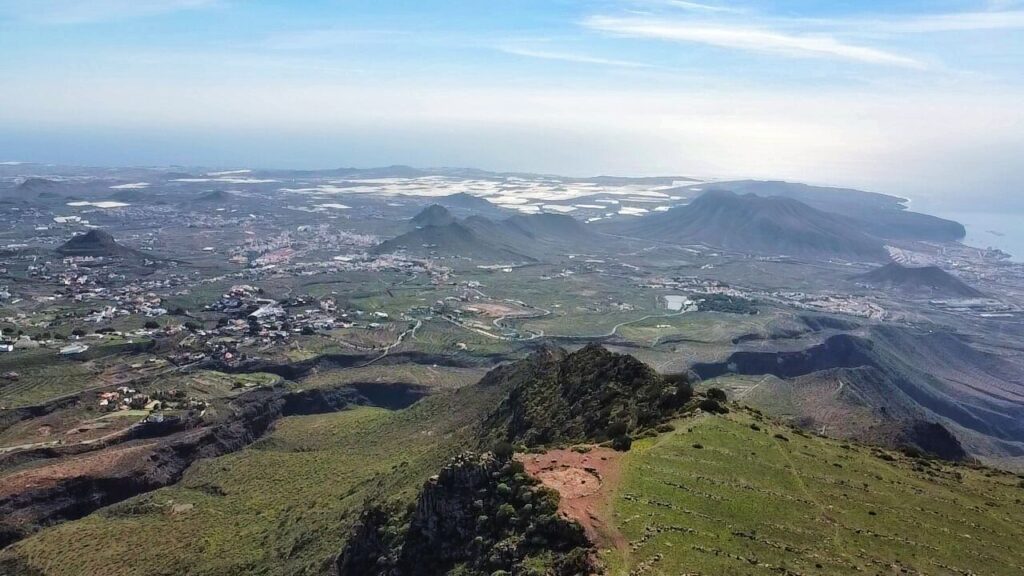
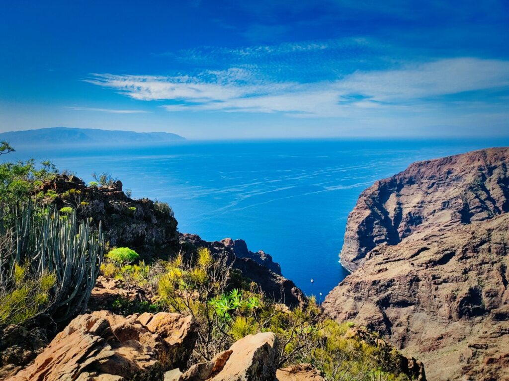
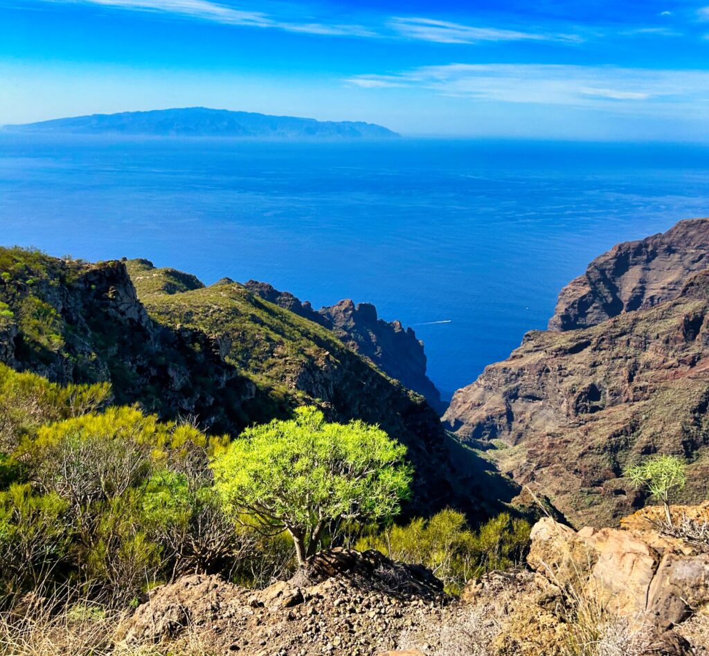
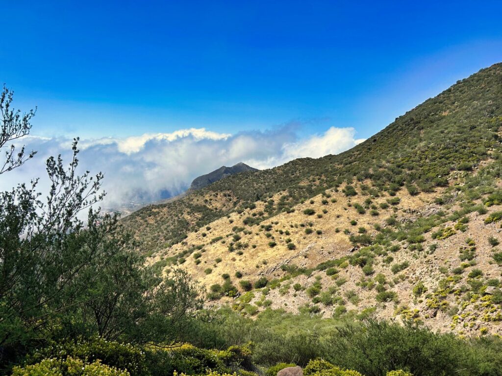
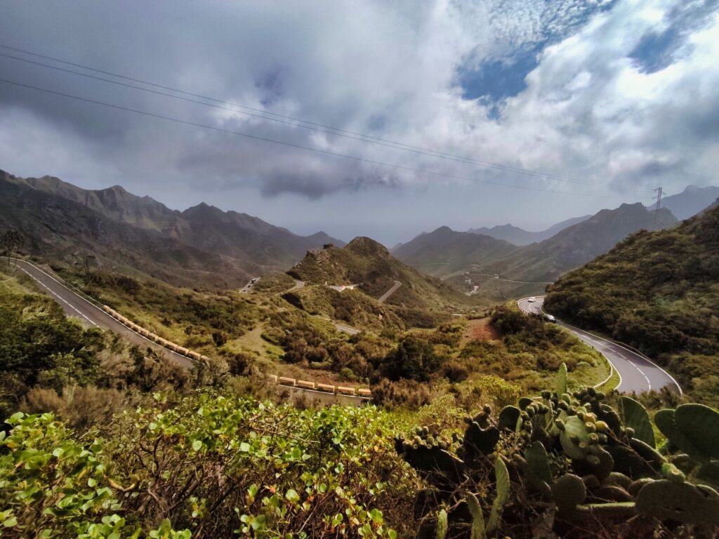
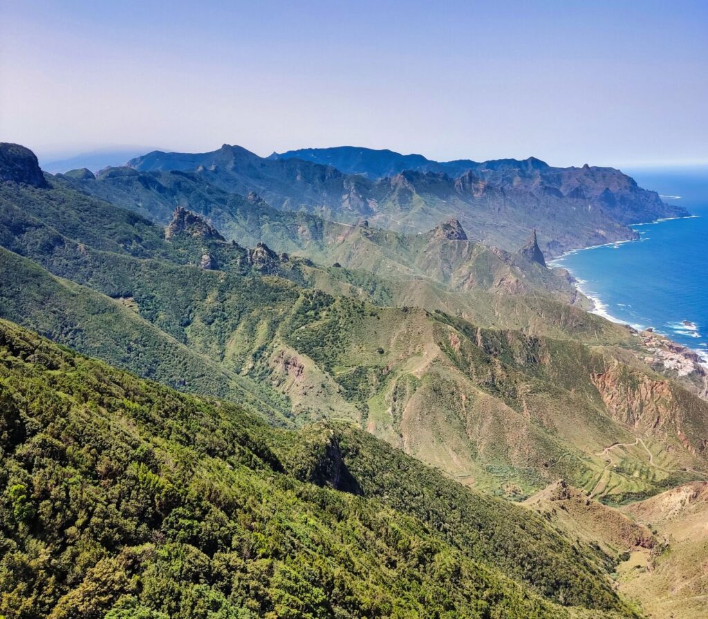
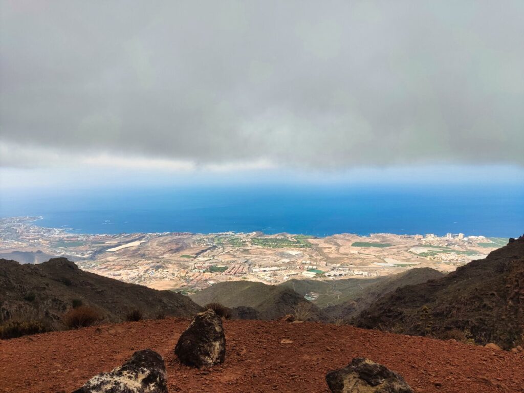
When people ask us what captivates us most about Tenerife, it’s not the beaches (though those black volcanic sands are mesmerizing) or the endless promenades filled with shops, restaurants, and tourists. Our Tenerife is defined by its diverse hiking trails — each offering unique terrain, landscapes, and climate experiences. The one-of-a-kind Anaga region wins in every category with its humid, dark green laurel forests. The cosmic, raw, and dry Las Cañadas caldera with Mount Teide, typically conquered under blazing sun, is equally unique in its own right. The challenging ravines winding through banana plantations and the remote trails of the Teno Peninsula are equally enchanting.
We’re excited to share with you the most beautiful walks and ideas for unforgettable trekking in Tenerife.
Why Tenerife is a Hiker’s Paradise
Hiking in Tenerife offers an incredible diversity that’s hard to find anywhere else in the world. From misty laurel forests that feel like stepping into a fairy tale, to lunar-like volcanic landscapes that could be mistaken for Mars, this Canary Island delivers experiences for every type of adventurer. Whether you’re seeking gentle walks in Tenerife suitable for families or challenging mountain hikes that test your endurance, the island’s varied terrain has something special waiting.
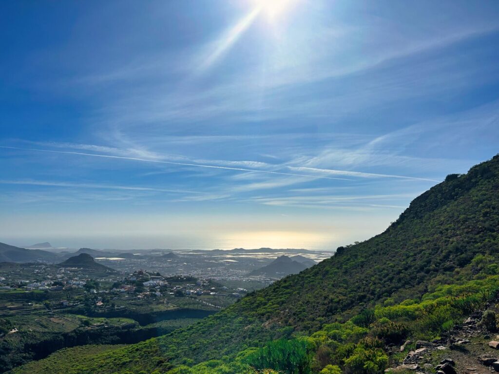
The beauty of Tenerife hiking lies in its accessibility — you can experience dramatically different ecosystems within a single day’s journey. Start your morning in the mystical cloud forests of Anaga, enjoy lunch with panoramic ocean views, and finish your day watching sunset from volcanic peaks above the clouds.
- Why Tenerife is a Hiker's Paradise
- Best Hikes in Tenerife: Complete Trail Guide
- Tenerife Hiking Trail #1: Roque de Taborno
- Tenerife Hiking Trail #2: Sendero de los Sentidos (Trail of the Senses)
- Tenerife Hiking Trail #3: Barranco del Infierno (Hell's Ravine)
- Tenerife Hiking Trail #4: Mirador de San Pedro – Ruinas de Gordejuela (Rambla de Castro)
- Tenerife Hiking Trail #5: Loop Around Chinyero Volcano
- Tenerife Hiking Trail #6: Roques de García
- Tenerife Hiking Trail #7: Benjo – El Draguillo Circuit
- Tenerife Hiking Trail #8: Roque del Conde
- Tenerife Hiking Trail #9: El Agujero (The Hole)
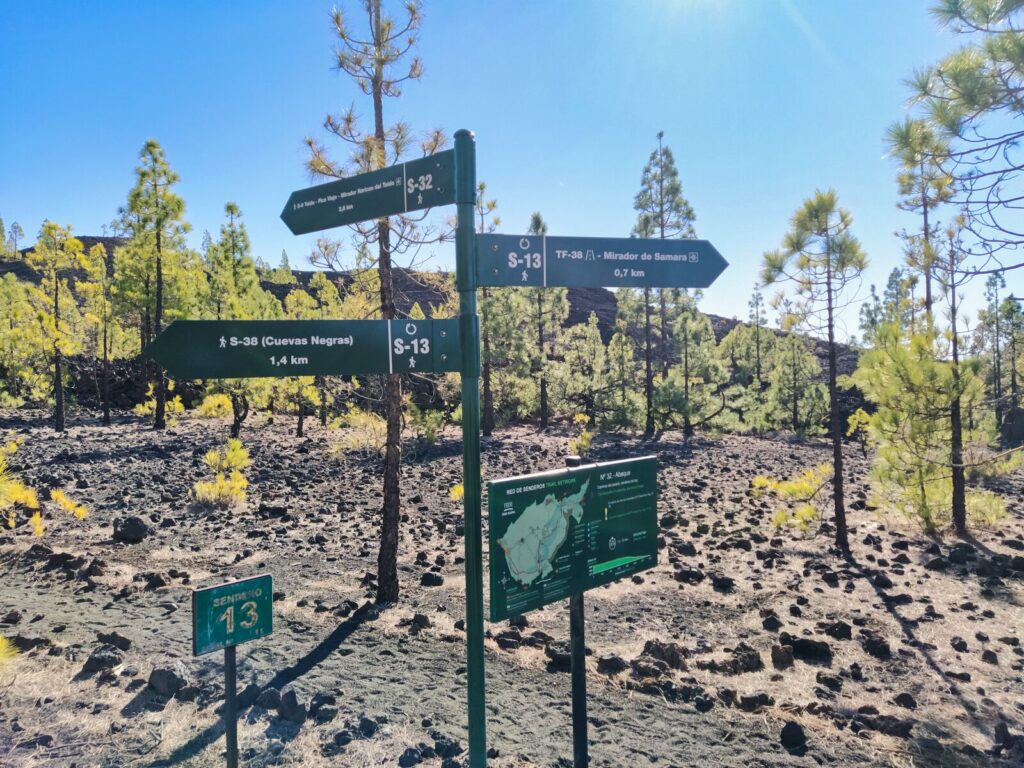
- Tenerife Hiking Trail #10: Mirador de Samara
- Tenerife Hiking Trail #11: Montaña Negra (Black Mountain)
- Tenerife Hiking Trail #12: Erjos – Charcas de Erjos
- Tenerife Hiking Trail #13: Mirador Narices del Teide – Refugio de Chasogo
- Tenerife Hiking Trail #14: El Pijaral (Enchanted Forest) – PERMIT REQUIRED
- Tenerife Hiking Trail #15: La Quinta – Boca del Paso
- Tenerife Mountains and Climate Considerations
- Essential Tips for Hiking Tenerife
- Your Complete Tenerife Hiking Adventure Awaits
- Frequently Asked Questions
- Rent our home
- Rent our home
Best Hikes in Tenerife: Complete Trail Guide
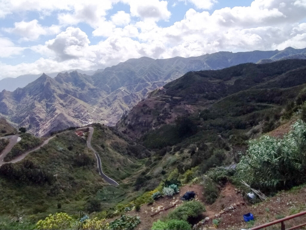
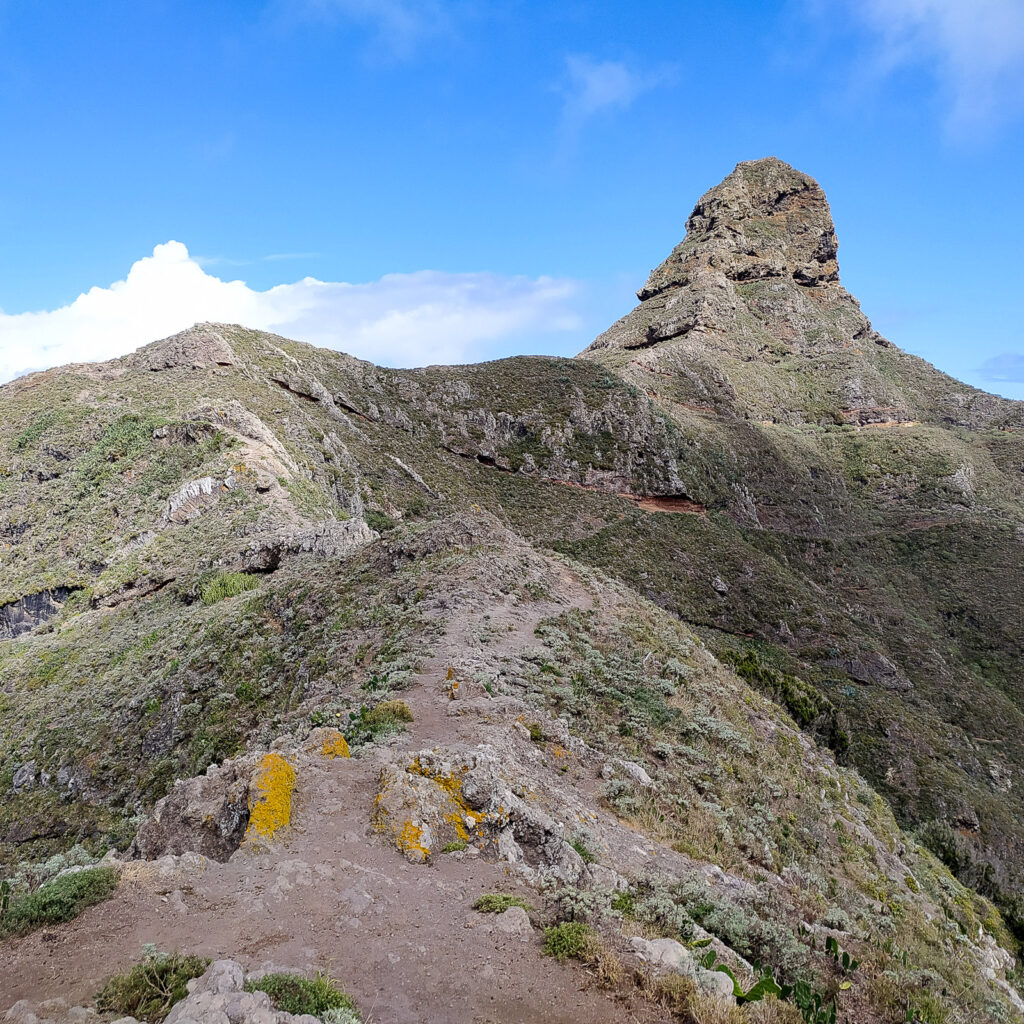
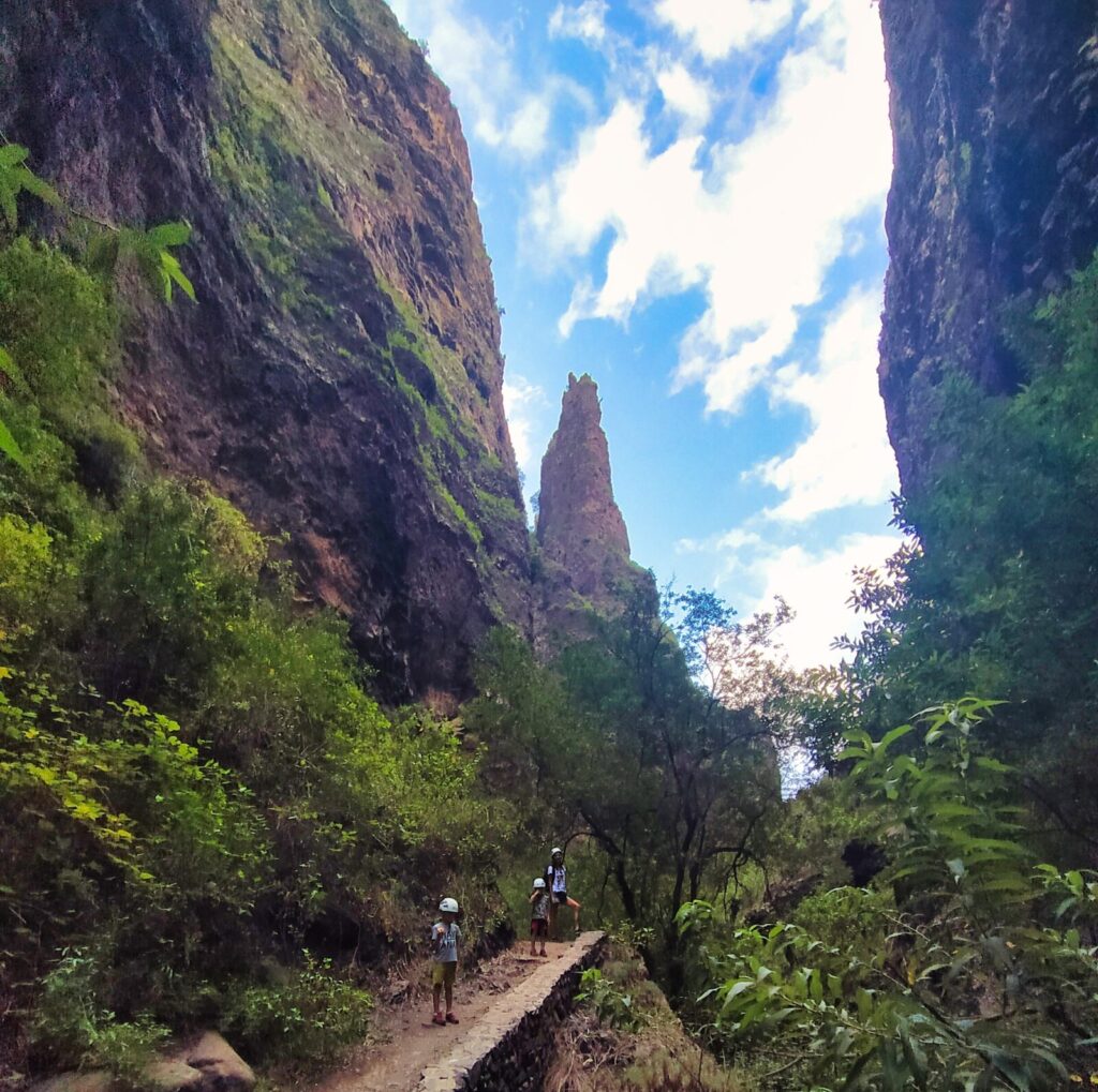
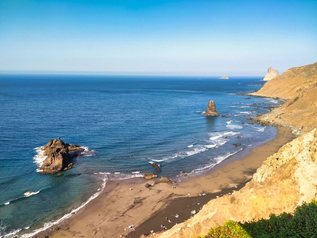
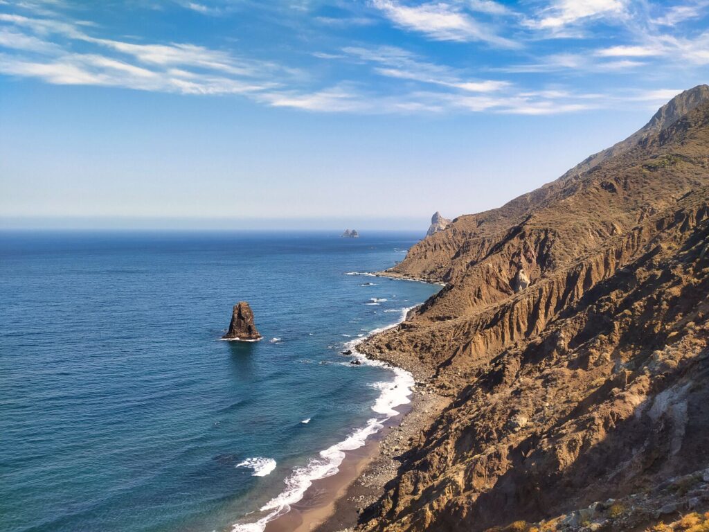
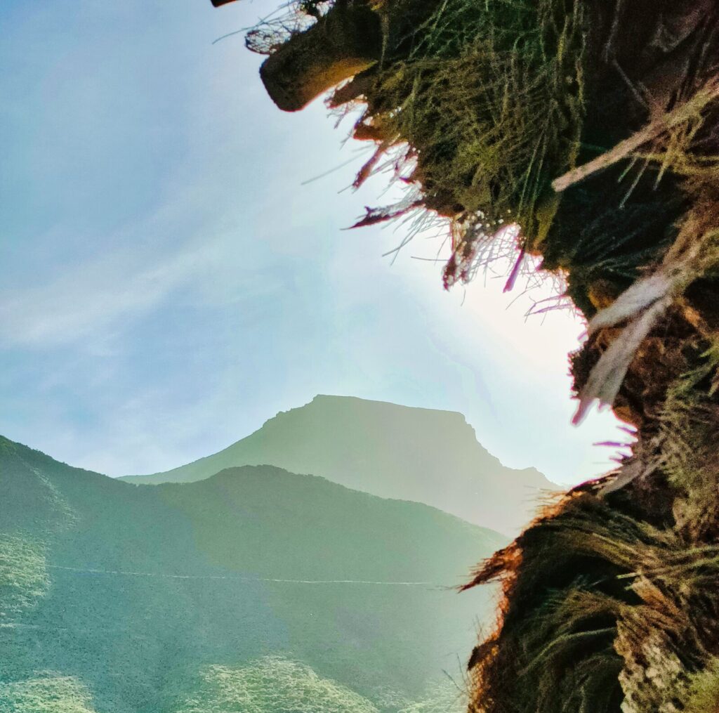
Tenerife Hiking Trail #1: Roque de Taborno
This ranks among the most spectacular hikes in Tenerife we’ve ever experienced. The route is relatively short at just 3.5 km, and for most of the journey, it’s not particularly demanding in terms of difficulty level — with small exceptions where the narrow path seems to slide off the mountainside. Every step rewards you with incredible views.
Did you know? Roque de Taborno is called the “Matterhorn of Tenerife” due to its distinctive shape resembling the famous Alpine peak.
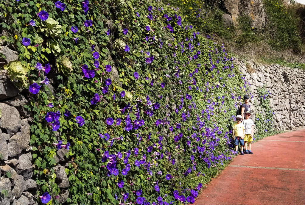
The hiking trail in the Anaga mountains around Roque de Taborno — a thumb-shaped rock formation rising 706 meters above sea level — begins behind the local chapel, then continues along paths around buildings and alongside a colorful wall of flowers leading to a viewpoint. From this point, the actual trail begins, forming a loop around the “thumb.”
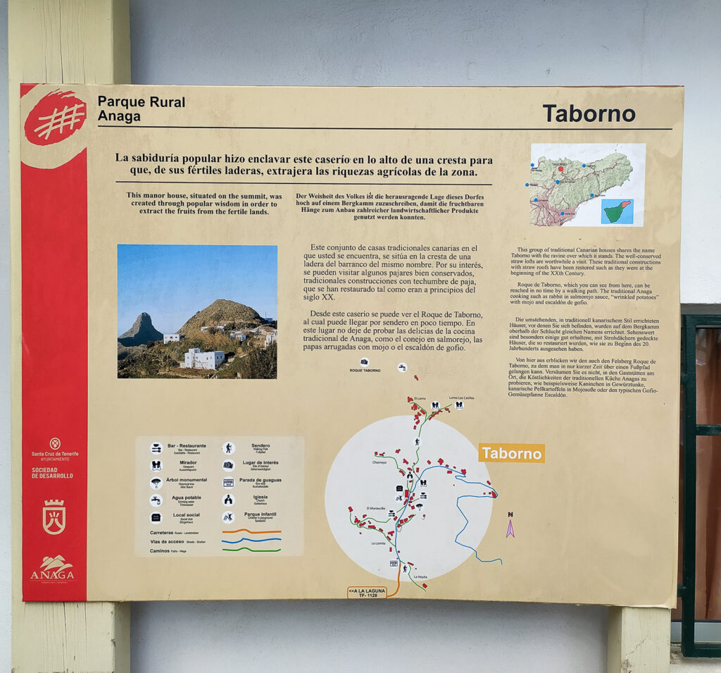
Trail Details:
- Distance: 3.5 km loop
- Duration: 1.5-3 hours depending on photo stops
- Difficulty: Easy to moderate
- Best for: Photographers and families with older children
The entire route can be completed in under 1.5 hours (according to guidebooks) or several hours if you stop frequently like we do to capture the northern coastline of Anaga. This is definitely one of the best hikes in Tenerife for those seeking dramatic coastal views without extreme difficulty.
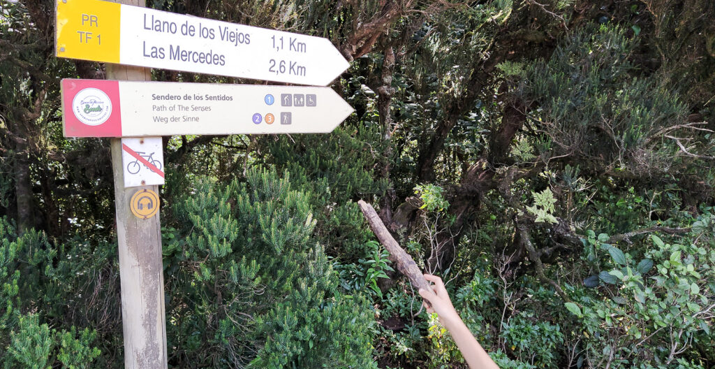
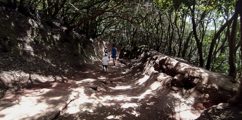
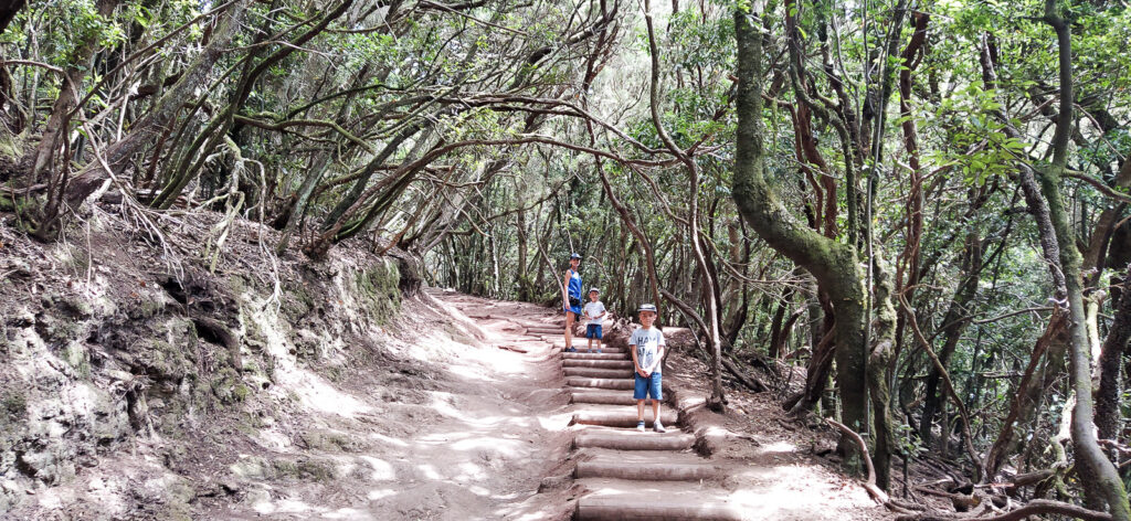
Tenerife Hiking Trail #2: Sendero de los Sentidos (Trail of the Senses)
Sendero de los Sentidos offers the perfect setting for a peaceful family walk in Tenerife — more of a gentle stroll than a challenging hike.
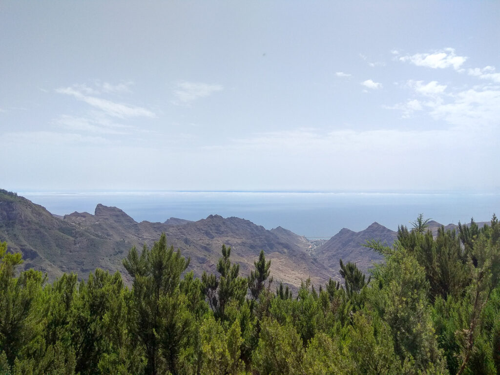
This sensory trail is located in the Anaga mountains (a mountain range situated on the northeastern tip of the island), specifically within the park designated as a Biosphere Reserve. The trail consists of three undemanding paths through dense laurel forest. The journey begins at Cruz del Carmen (a viewpoint) and reaches its furthest point at Mirador del Llano de los Loros (another spectacular viewing location).
Each trail offers experiences that stimulate your senses of smell, sight, and touch. Along the way, you’ll encounter signs marked with sensory symbols (nose, hand, or eye) that encourage not just children, but adults too, to smell, touch, or observe specific elements along the path.
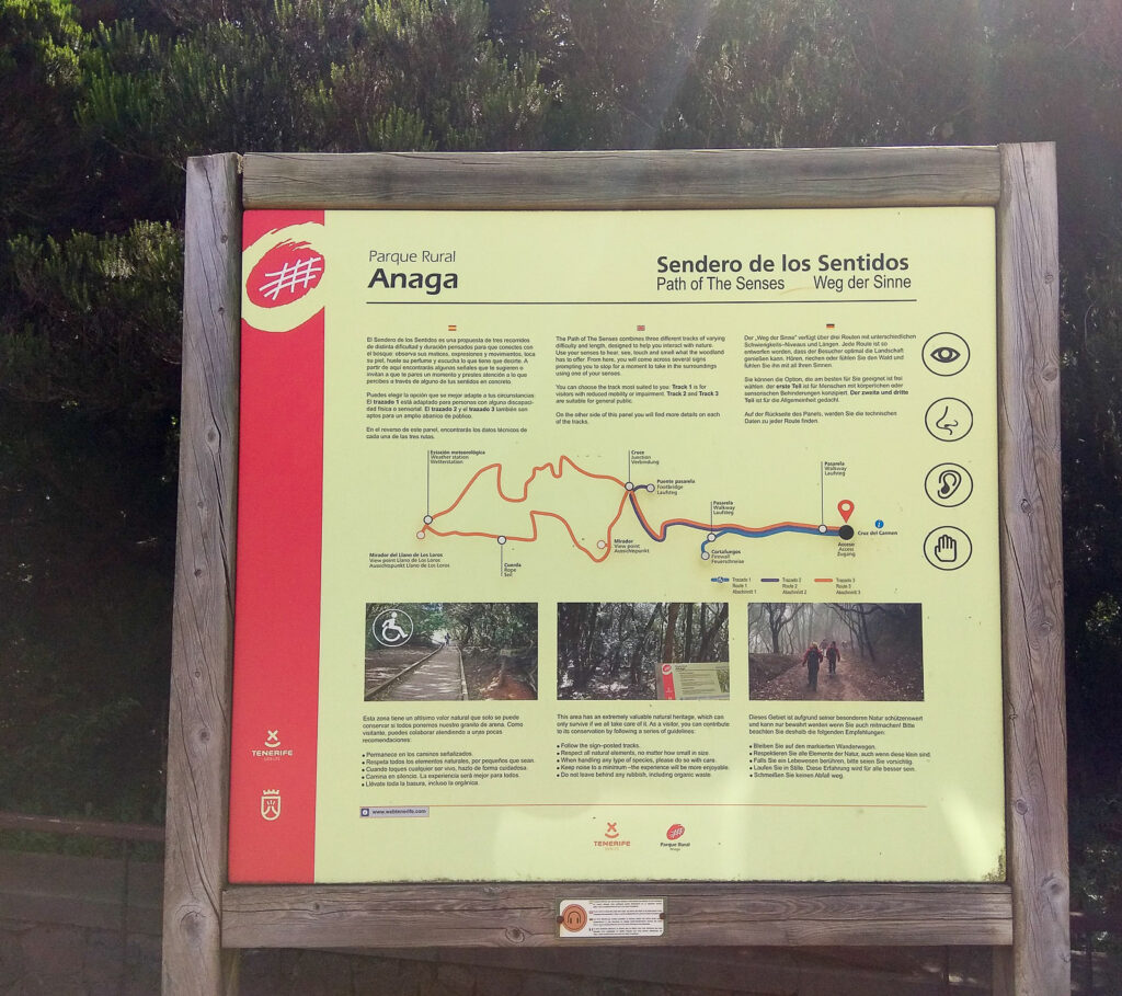
Trail Highlights:
- Distance: Various interconnected paths (2-4 km total)
- Duration: 1-2 hours
- Difficulty: Easy – perfect for families
- Special feature: Interactive sensory experiences throughout
When to visit: If you want to feel like you’re in “Lord of the Rings,” a misty morning is perfect. During hot summer days, you can always find cooling shade here at any time. This trail easily makes our list of best walks in Tenerife for families with children.
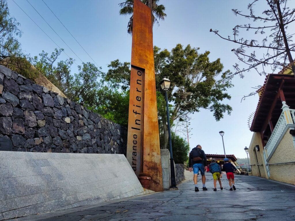
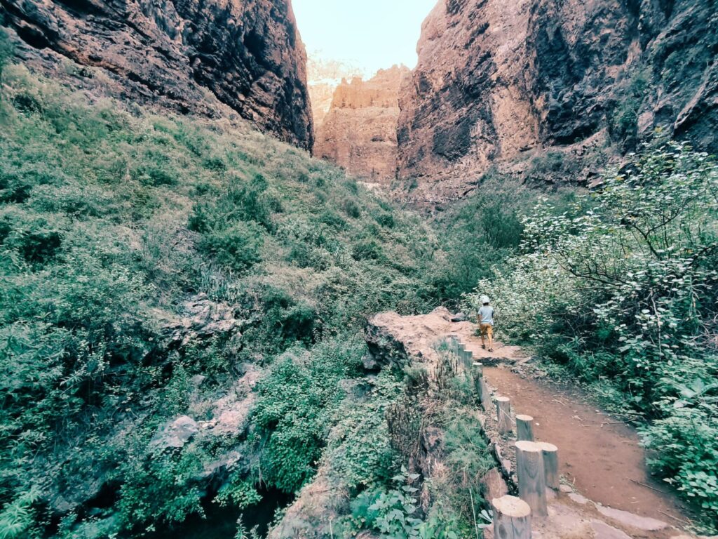
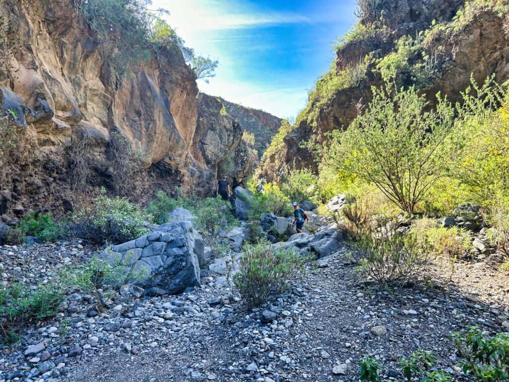
Tenerife Hiking Trail #3: Barranco del Infierno (Hell’s Ravine)
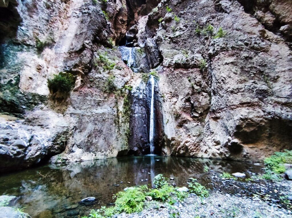
Barranco del Infierno is a nature reserve, so to protect the local flora and fauna, access to the ravine is limited to 20 people every half hour. Advance reservation is required to enter this protected natural area.
The designated trail is approximately 6.5 km long (round trip) and takes about 3 hours to complete. The elevation ranges from about 100 to 1,300 meters, which means both flora and fauna showcase incredible diversity. You’ll encounter several varieties of tabaiba, Canary pines, jasmine, even palms and chestnut trees. Sharp-eyed visitors might spot common kestrels, hawks, ravens, or robins.
Reservation Information:
- Website: https://www.barrancodelinfierno.es/reservar
- Capacity: 20 people every 30 minutes
- Duration: 3 hours round trip
- Highlight: 200-meter waterfall at the trail’s end


The trail follows old shepherd paths, then continues along the increasingly narrow ravine bed, culminating when you reach a waterfall in Tenerife over 200 meters high. This waterfall is particularly spectacular after winter rains.
Did you know? Local legends call Barranco del Infierno the “mouth of El Teide volcano” and it’s considered the deepest gorge in the Canary Islands.
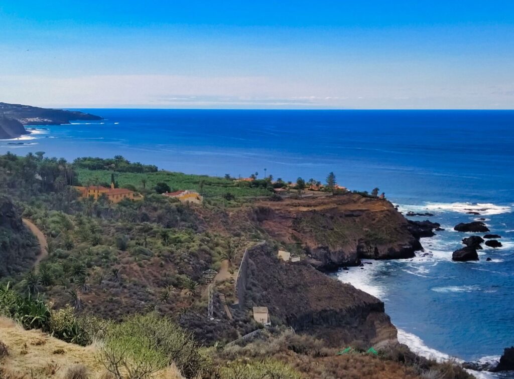
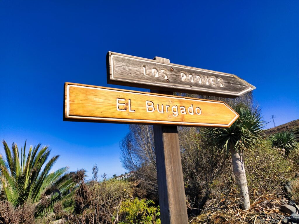
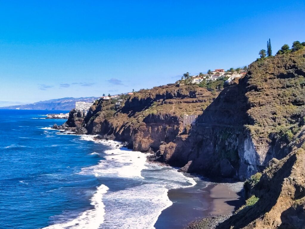
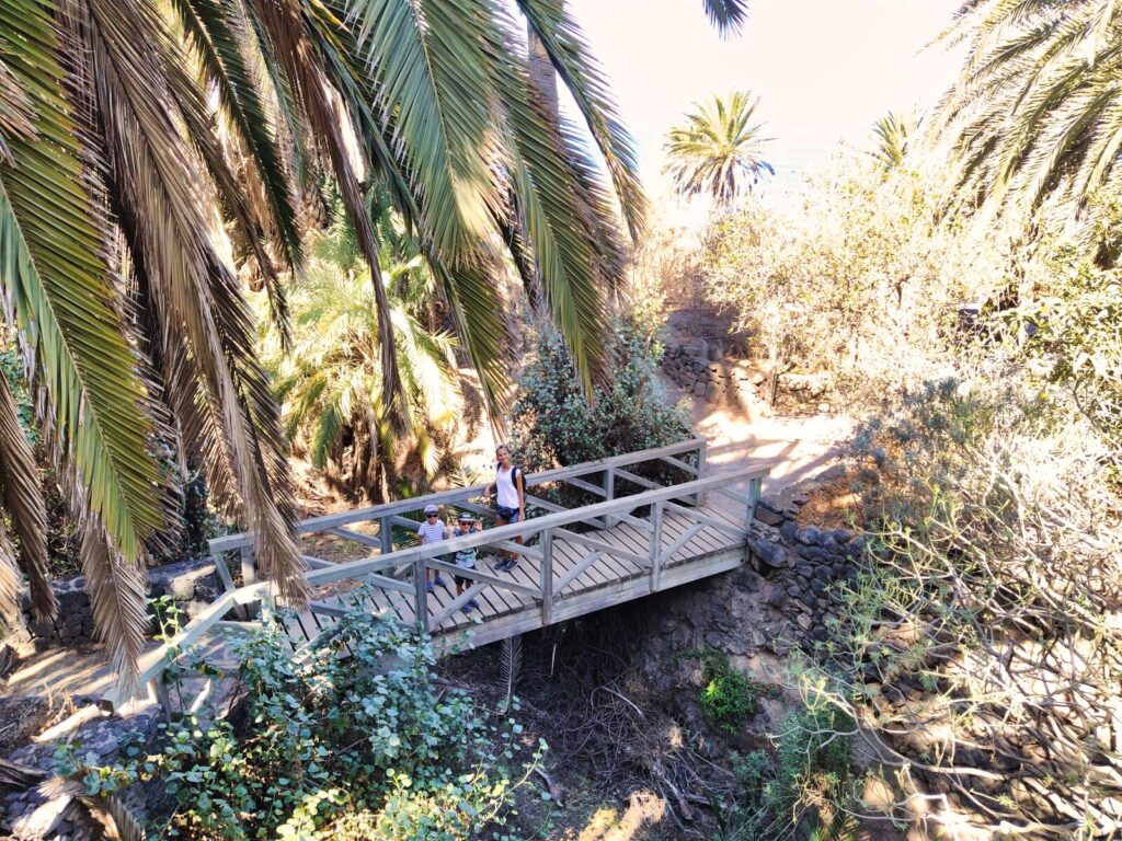
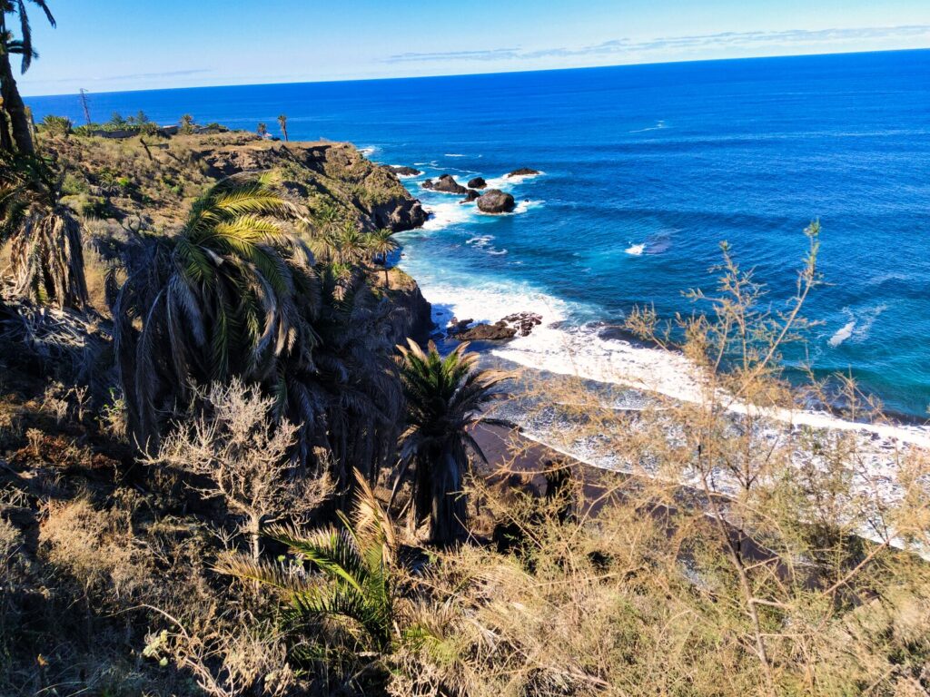
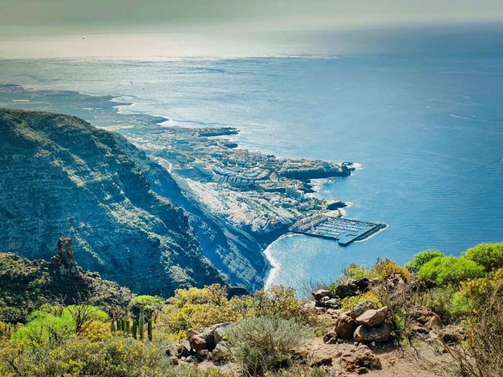
Tenerife Hiking Trail #4: Mirador de San Pedro – Ruinas de Gordejuela (Rambla de Castro)
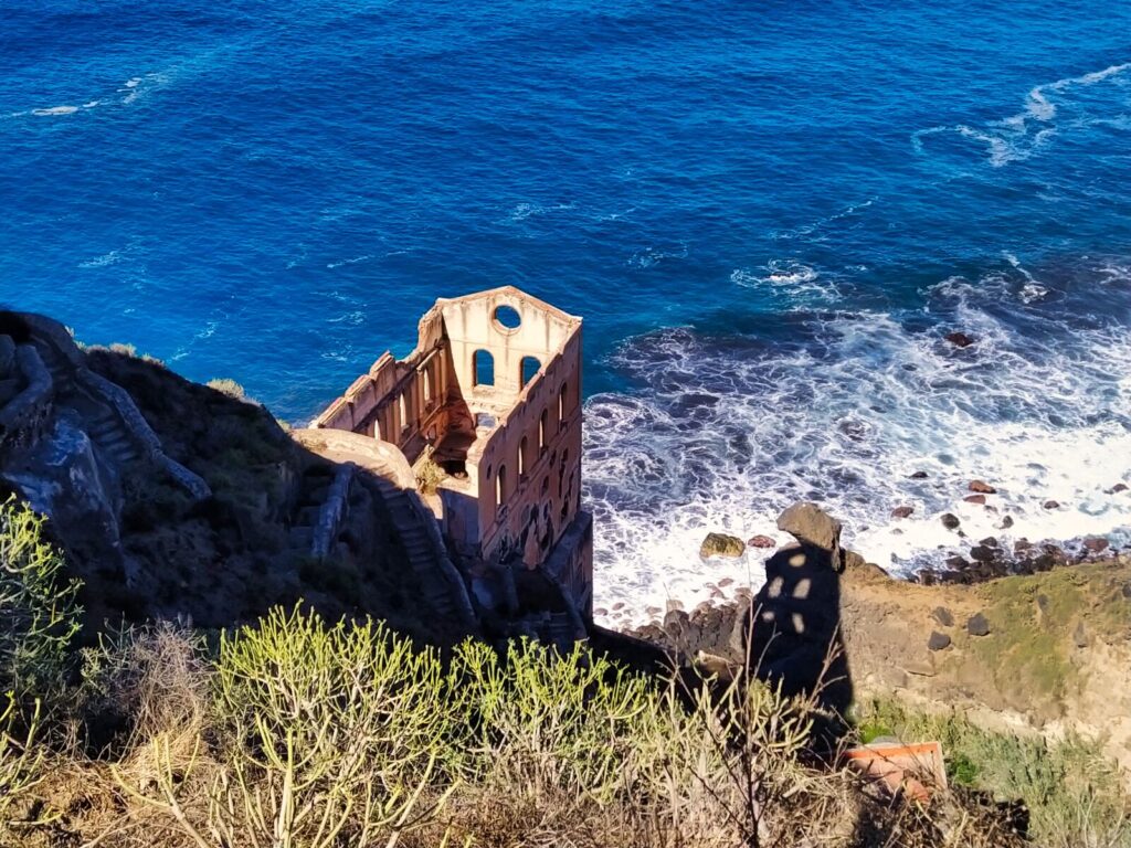
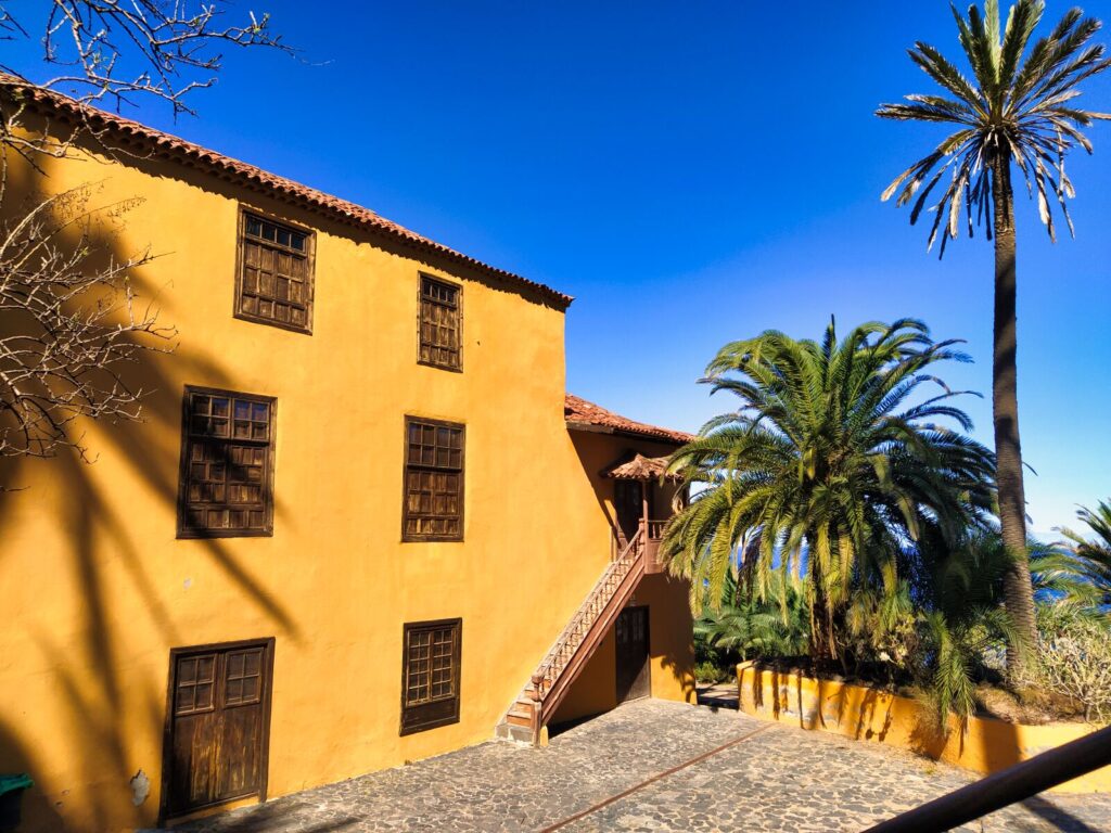
The “Rambla de Castro” trail measures just under 5 km. This walk through the island’s best-preserved palm grove (specifically on the Los Realejos coast) proved to be a delightful stroll through a natural botanical garden with stops to admire Canarian architecture and defensive structures.
Historical Highlights:
- La Casona de los Castro: A typical Canarian villa — a massive yellow house with wooden windows built in the 16th century after Tenerife’s conquest
- Fort San Fernando: A small 18th-century defensive fortress with 3 remaining cannons (out of original 5) that protected this part of the island from pirates and enemies
The trail runs along the cliff coastline. After a quick coffee at the Mirador de San Pedro restaurant and café, we headed downhill behind the chapel to the most protruding point of this part of the island, where you can admire how the turbulent ocean waters crash against the rocky coastline.
Trail Features:
- Distance: Under 5 km
- Terrain: Coastal cliffs with historical sites
- Best for: History enthusiasts and photography
- Special attraction: 19th-century water elevator ruins (Elevador de agua de la Gordejuela)
Did you know? The ruins of Elevador de agua de la Gordejuela represent a 19th-century engineering marvel — a water elevator that lifted water from the coast to irrigation areas in the Orotava Valley.
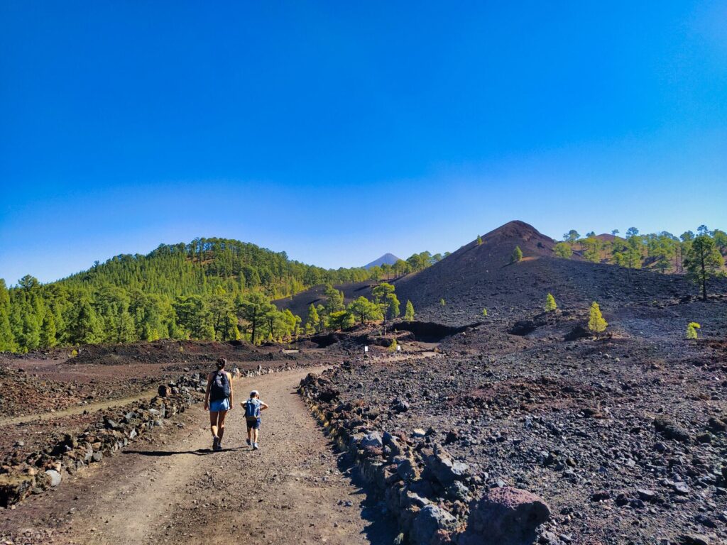
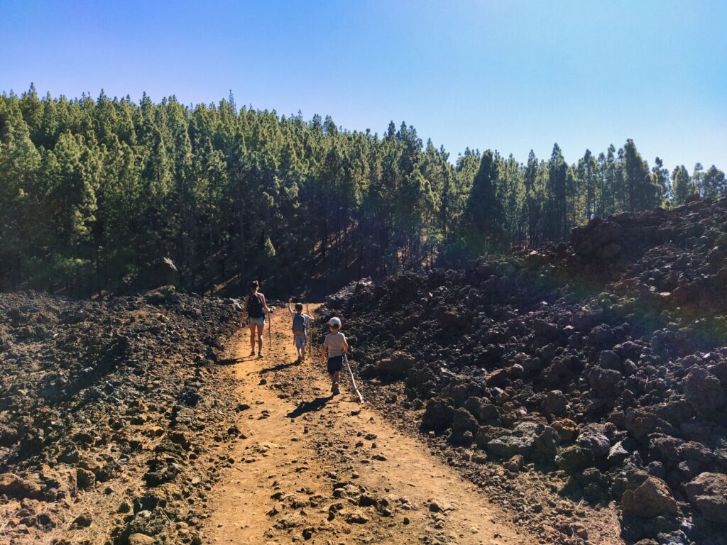
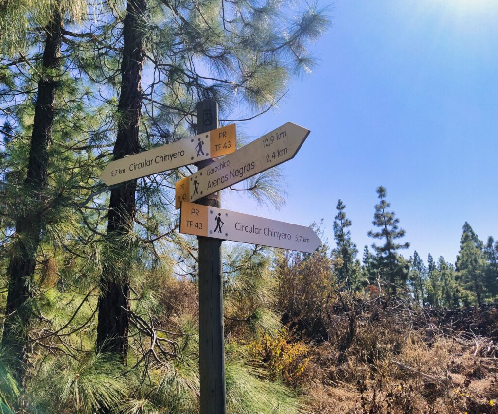
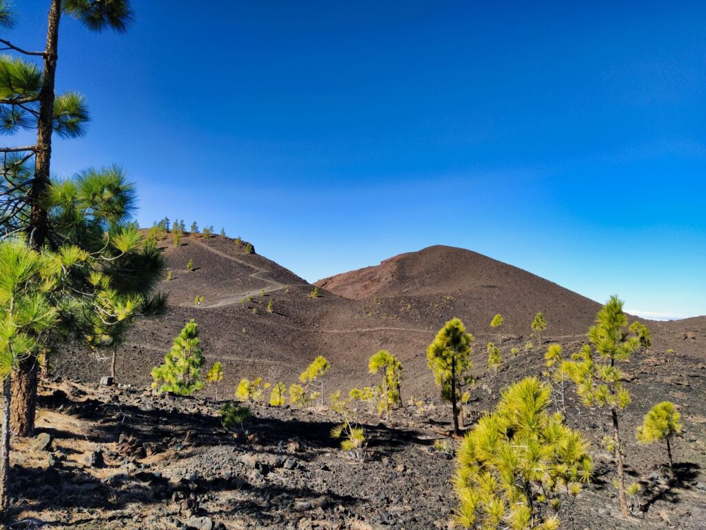
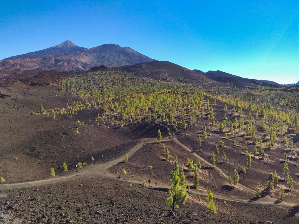
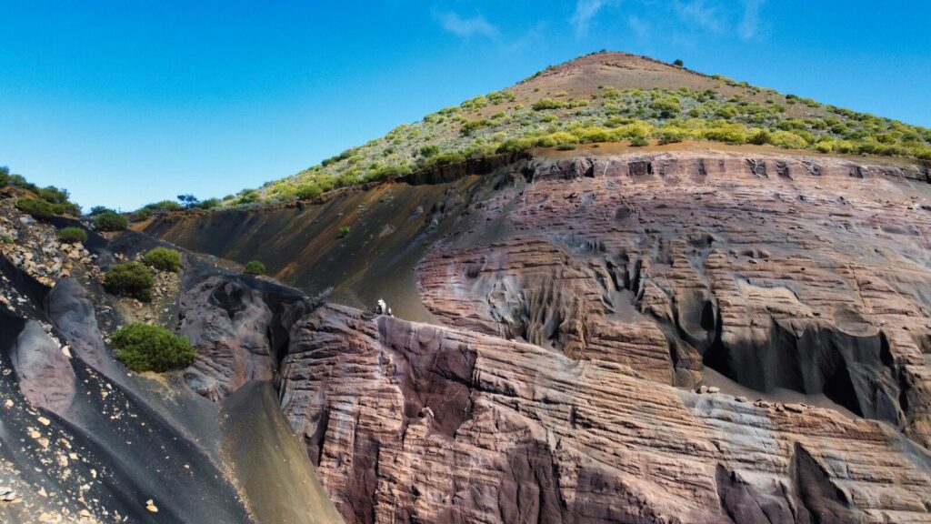
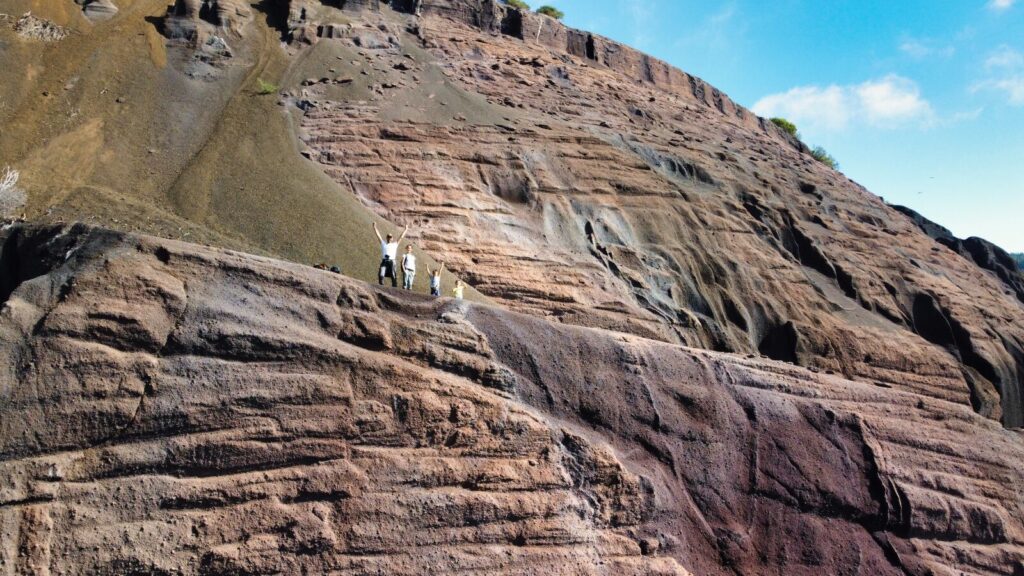
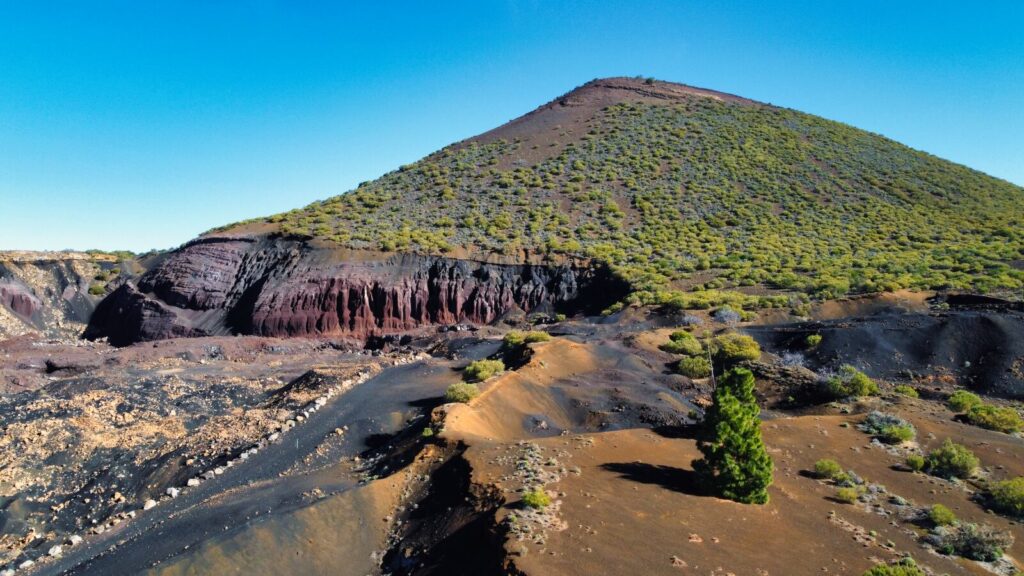
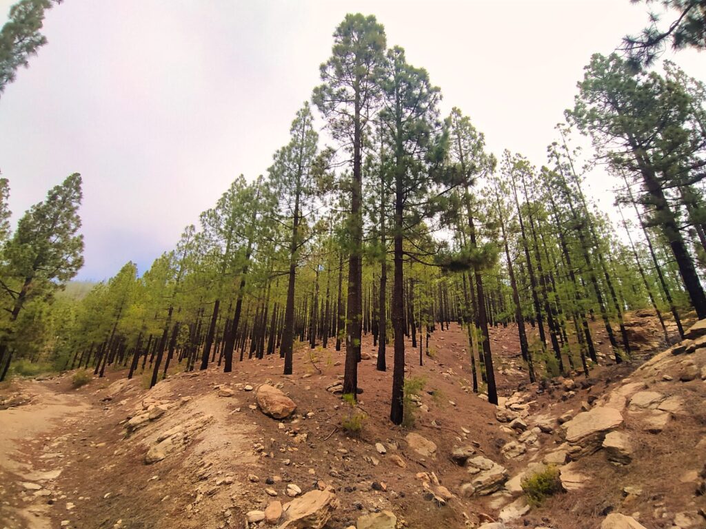
Tenerife Hiking Trail #5: Loop Around Chinyero Volcano
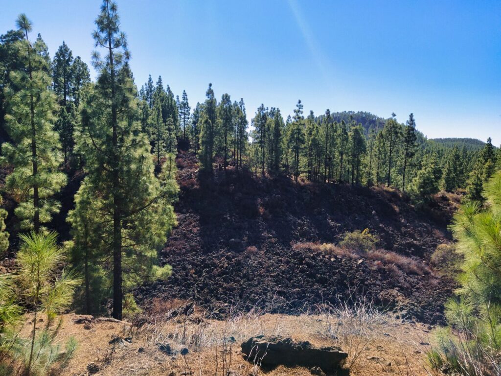
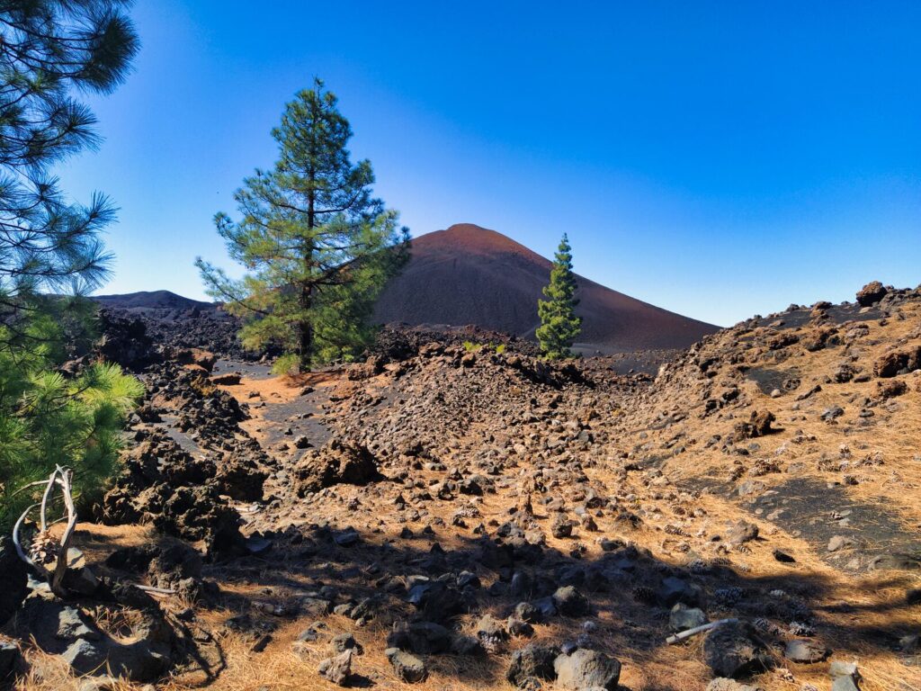
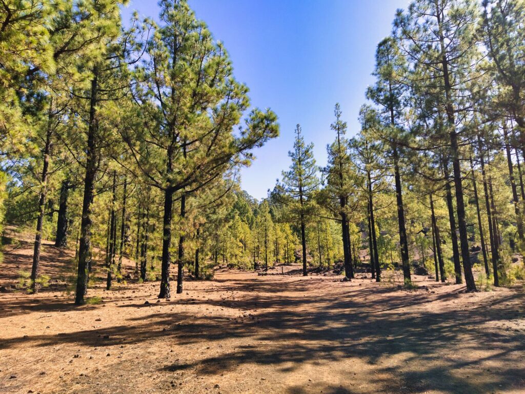
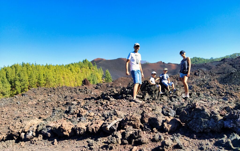
One of the trails around Chinyero volcano (elevation 1,561 meters) forms a complete loop. The route in Chinyero Special Nature Reserve measures 5.7 km. This has been our best hike in Tenerife’s volcanic terrain so far.
Chinyero is an extinct volcano whose last eruption occurred in 1909. The lava expelled during that eruption covers a significant portion of the trail, partly through pine forest as well.
What makes this trail special:
- Distance: 5.7 km loop
- Elevation: 1,561 meters
- Difficulty: Moderate
- Unique features: 1909 lava flows, charred pine bark, volcanic landscapes
The terrain, despite neighboring a volcano, is incredibly diverse. The trail begins in a pine forest where only the charred bark of pines reminds you of the recent eruption. Further along, the path climbs upward, but the route remains very pleasant as the shade of trees and considerable altitude above sea level provide coolness during hot November afternoons (around 19 degrees Celsius).
The forest occasionally becomes sparser, eventually revealing complete streams of lava from the last eruption. The views are incredible — Martian surfaces, individual pines seemingly trying to climb closer to the crater, pine cone fields, lava dunes…
Did you know? During Chinyero’s last eruption in 1909, local residents placed a statue of the Virgin Mary facing the lava flow, which legend says stopped its advance.
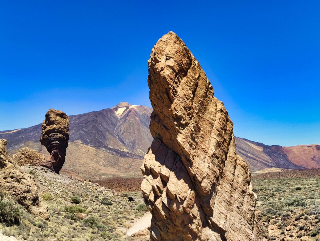
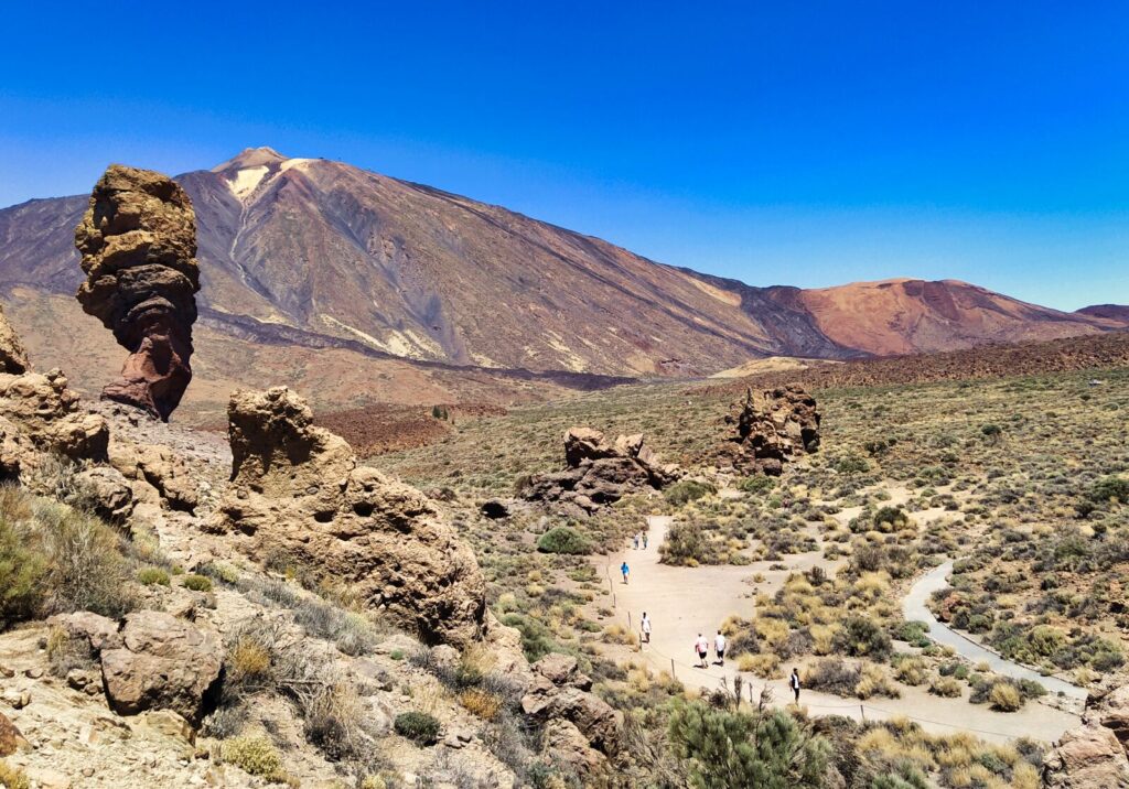
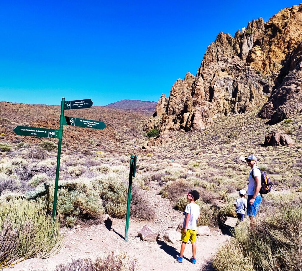
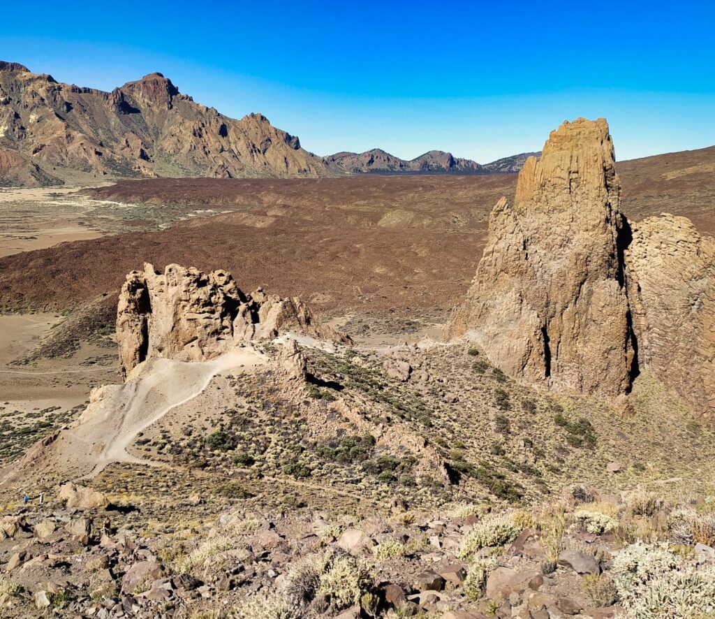
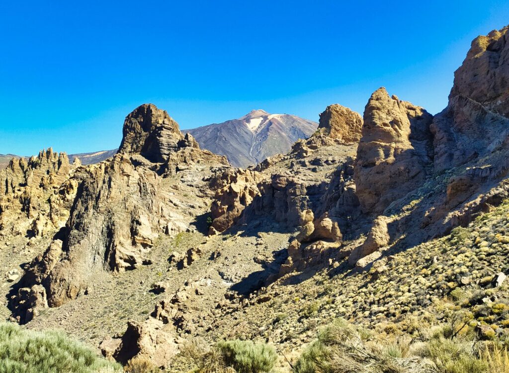
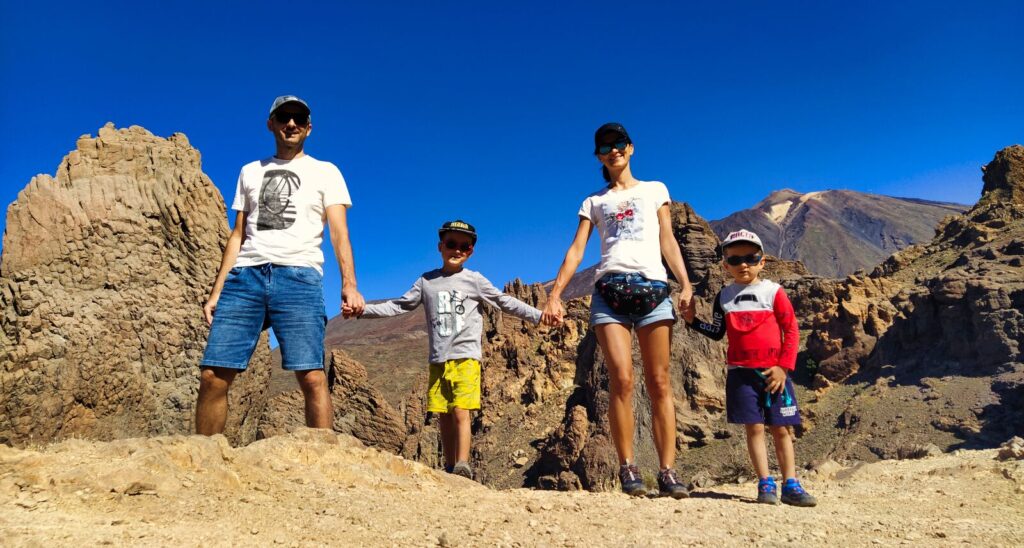
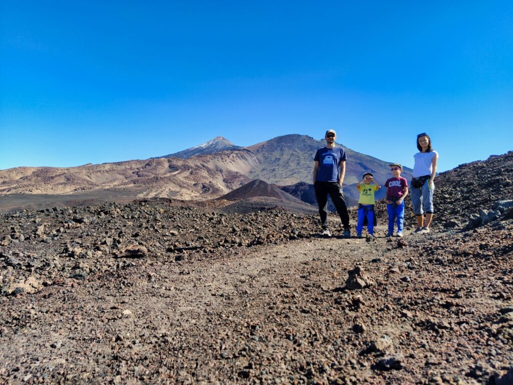
Tenerife Hiking Trail #6: Roques de García
The entire trail measures about 3.5 km. An hour and a half provides sufficient time to complete the loop without breaks. Expeditions with children take longer. Spectacular views await — best of all — accessible even for those inexperienced in hiking.
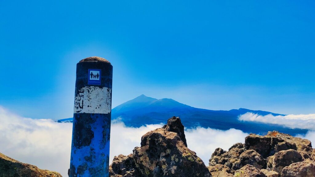
Convenient access to parking located at about 2,200 meters above sea level allows you to admire a significant portion of the Las Cañadas caldera from the very beginning — the depression left by the previous gigantic volcano.
Trail Highlights:
- Distance: 3.5 km loop
- Elevation: 2,200 meters
- Duration: 1.5-2 hours with children
- Setting: Teide National Park (UNESCO World Heritage Site)
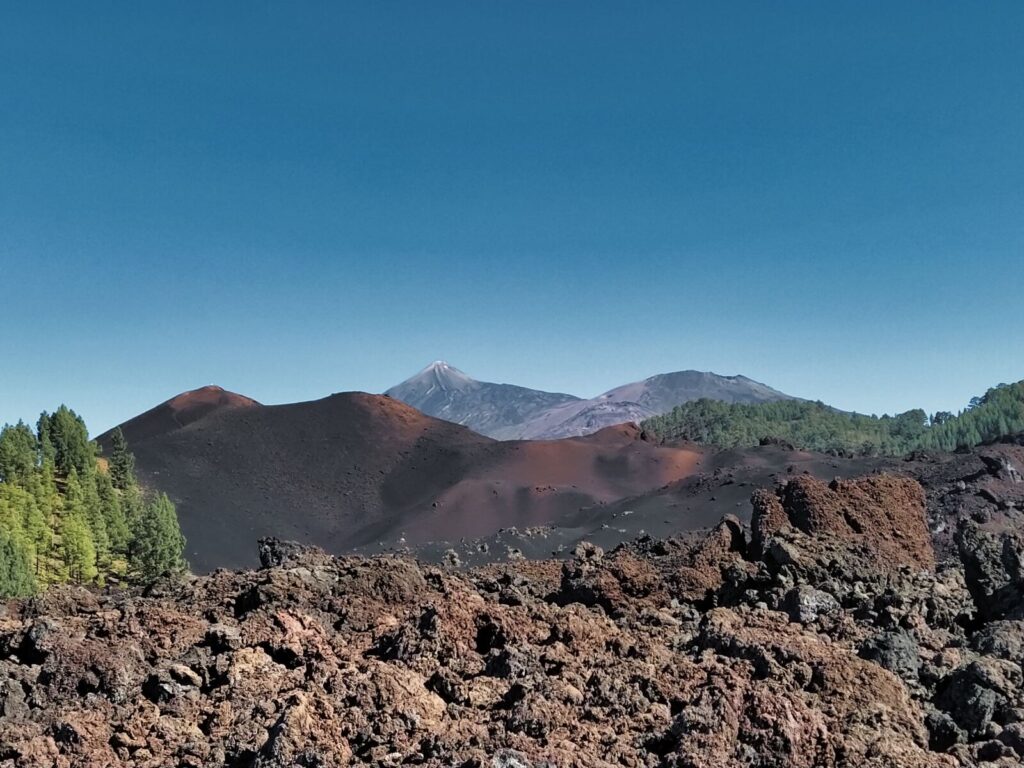
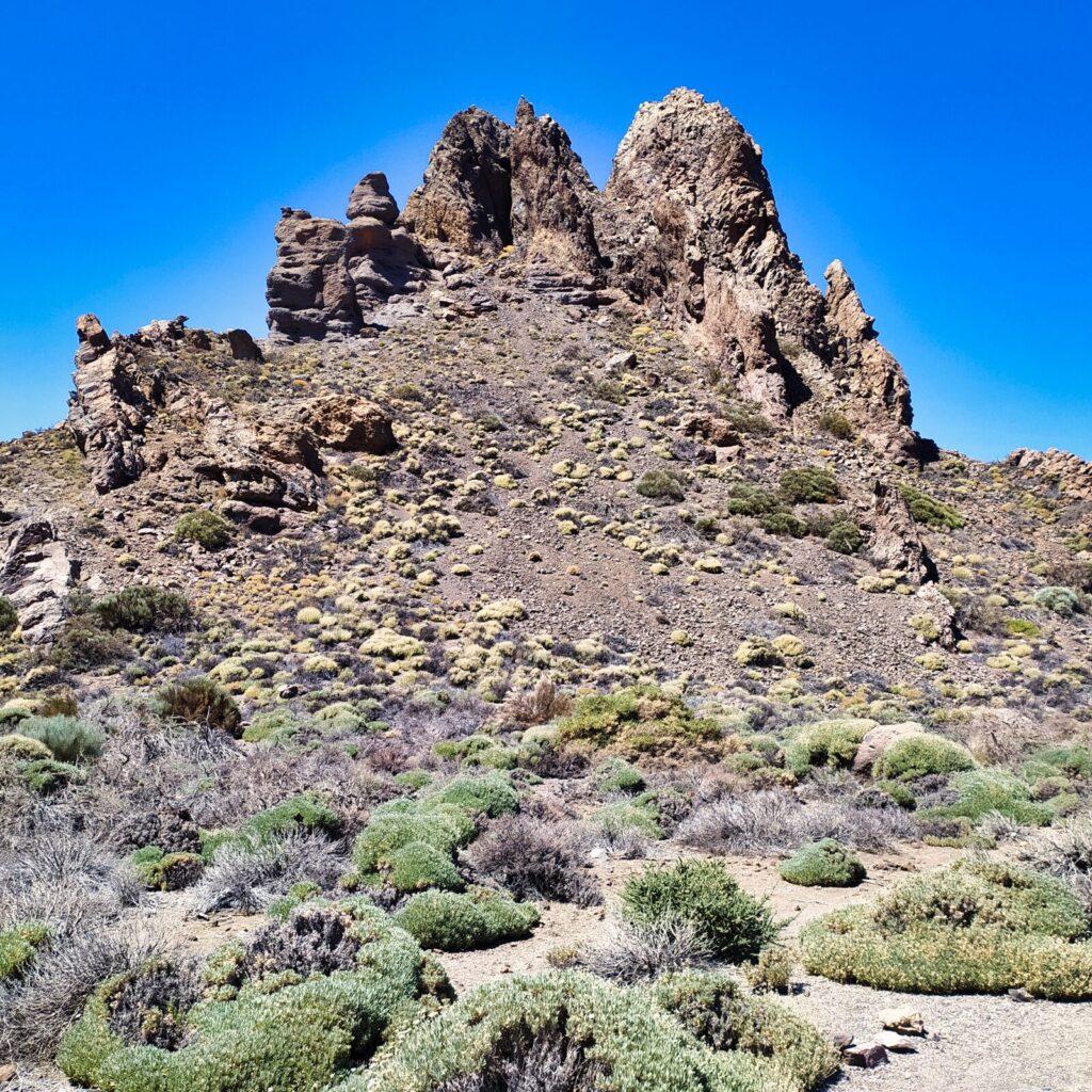
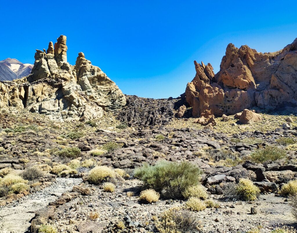
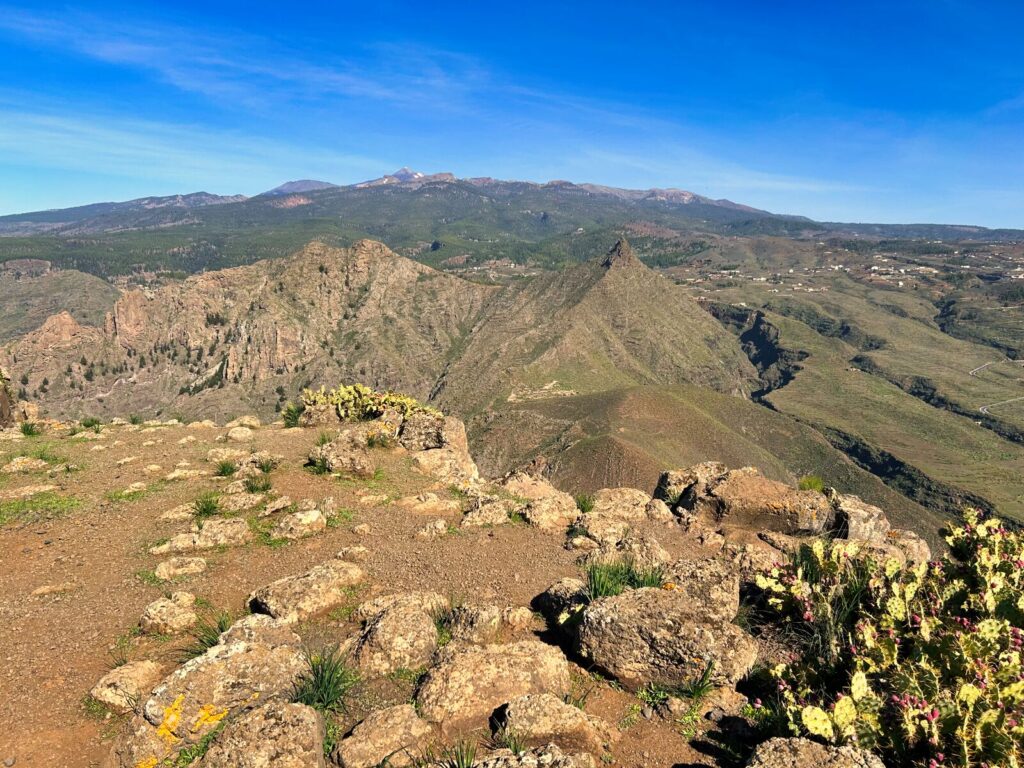
Once again, the landscape is unique — raw, sometimes resembling the red surface of Mars, so different from the lush, dark green scenery of the Anaga mountains in northern Tenerife. You’re walking through Teide National Park, and Pico del Teide accompanies hikers throughout the background.
Our chosen trail around Roques de García (rock formations created by accumulation of various materials that over time were interrupted by erosion, forming huge and diverse rock groups) begins at the Mirador de la Ruleta viewpoint.
Notable formations you’ll see:
- La Catedral (The Cathedral): First major rock formation
- Roque Cinchado: The famous “Stone Tree” featured in countless photos
- Black lava “waterfall”: Frozen volcanic flow between rock formations
Our experienced 4-year-old completed Trail #3 without major problems from first to last meter, though many passing adult “tourists” turned back, probably overwhelmed by the trail length or heat.
Did you know? Roque Cinchado, also called the “Finger of God,” appears on old Spanish peseta banknotes and is one of Tenerife’s most photographed natural landmarks.
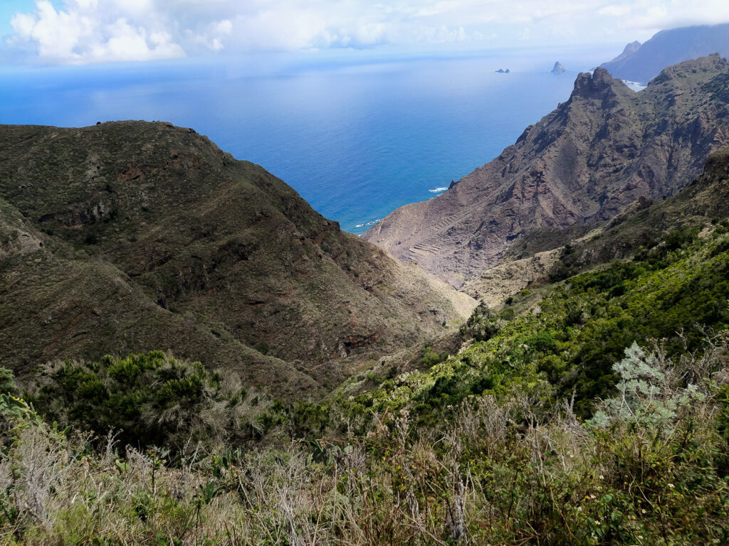
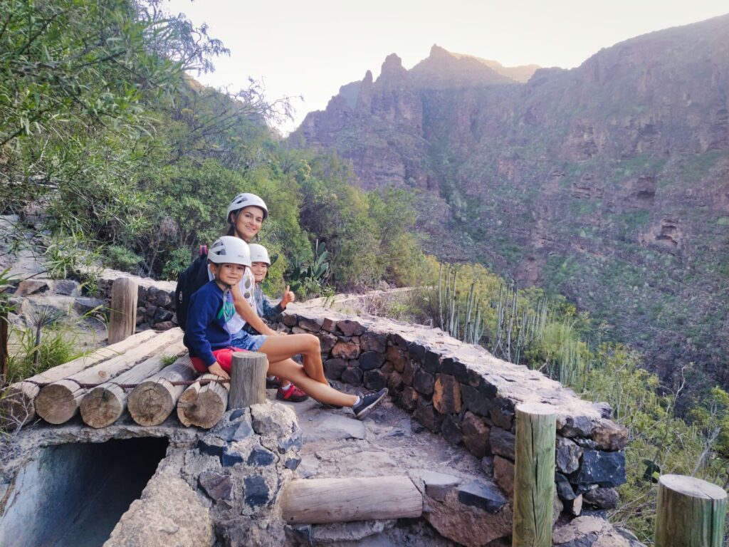
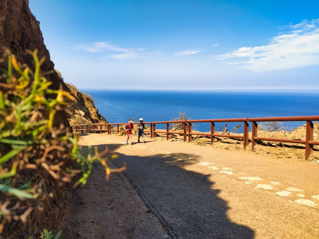
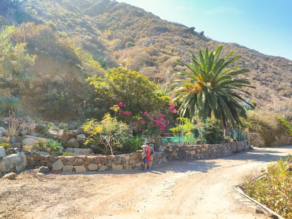
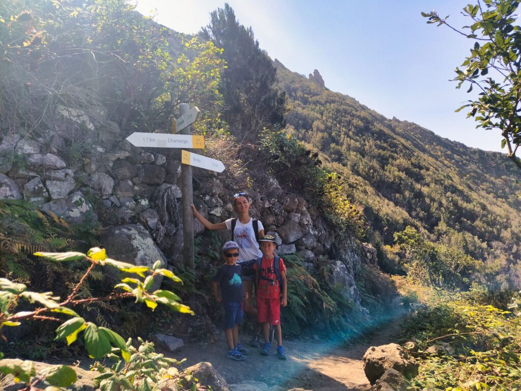
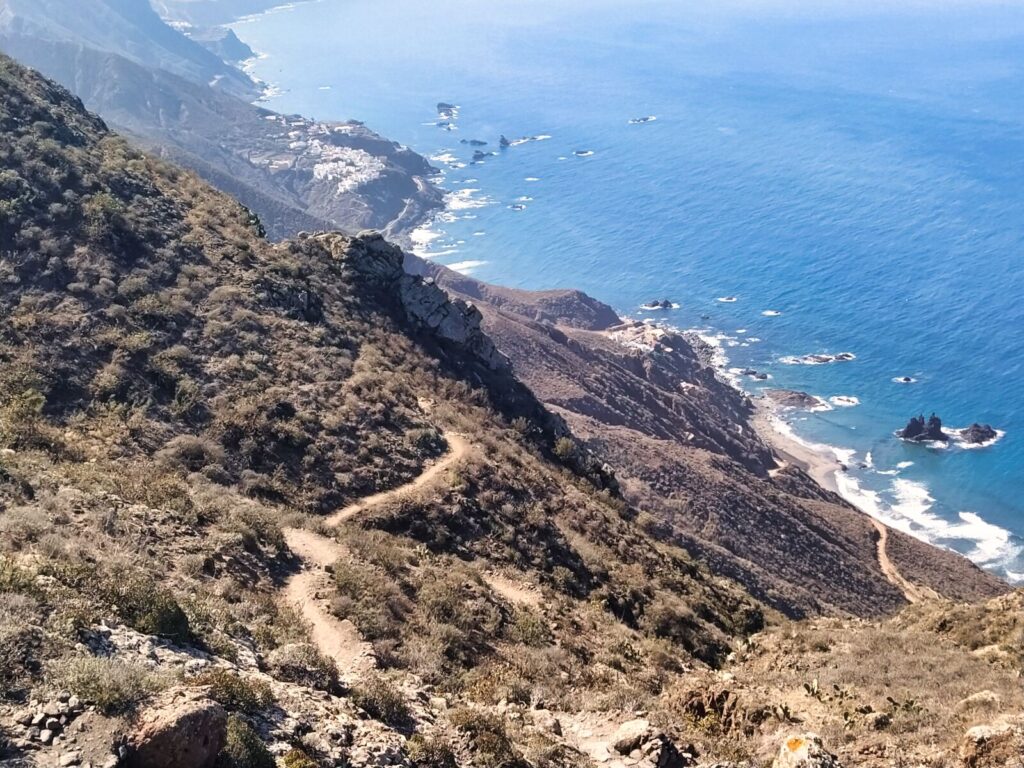
Tenerife Hiking Trail #7: Benjo – El Draguillo Circuit
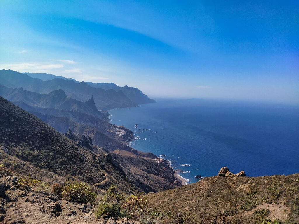
We conclude our Anaga adventures with an amazing Tenerife hiking trail. We managed to complete this loop with our children as well. We covered the 5.4 km route with about a half-hour picnic lunch break in just under 3 hours.
We began our hike at the parking area above Benjo beach on the internal road for El Draguillo residents. After passing the small “town,” we turned right toward Chamorga, and halfway through the trail, turned again toward Benjo.
Trail Details:
- Distance: 5.4 km loop
- Duration: 3 hours including breaks
- Terrain: Coastal cliffs and rural villages
- Difficulty: Moderate with some challenging sections
Did you know? This route offers some of Tenerife’s most beautiful coastlines, where rugged cliffs meet the wild ocean. You’ll discover hidden black sand beaches accessible only during this hike.
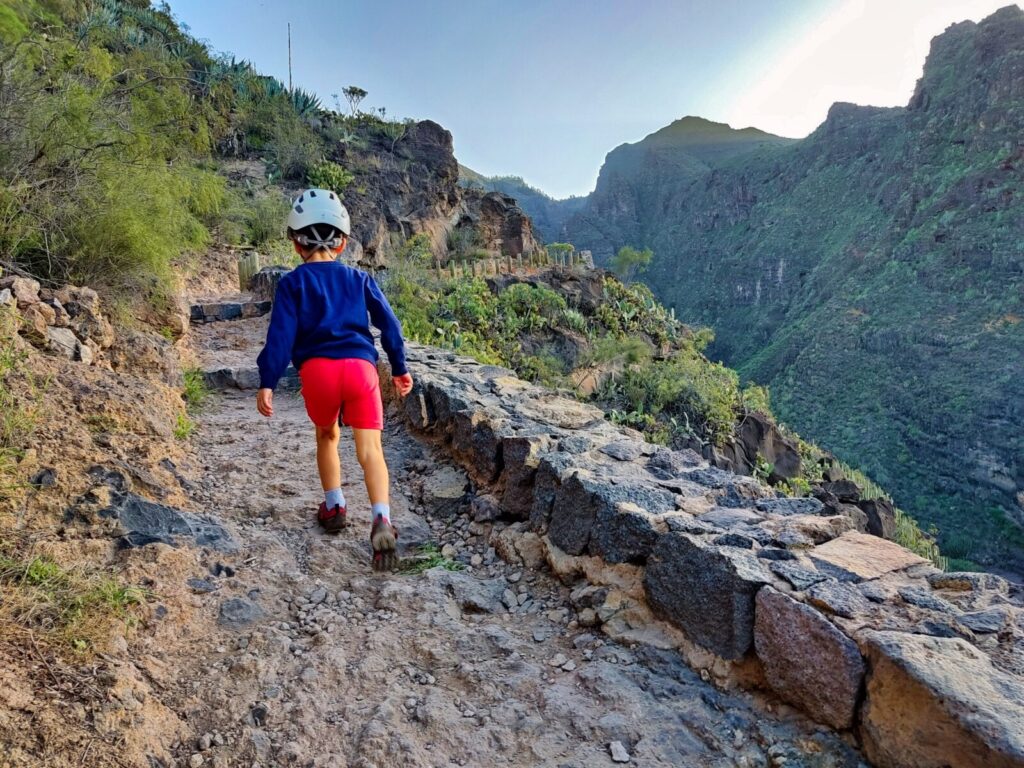
Tenerife Hiking Trail #8: Roque del Conde
We climbed Roque del Conde on New Year’s Eve 2023 when weather conditions were perfect for a summit hike. Mountain weather often differs significantly from beach conditions, but we encountered sunny, cloudless conditions.
We completed 5.18 km of trail, classified by the tourism guide as moderately difficult. The trail proved not overly long — you should reserve about 4 hours total with rest time at the summit.
Summit Details:
- Elevation: Nearly 1,000 meters
- Distance: 5.18 km
- Difficulty: Moderate to difficult
- Best for: Experienced hikers without height anxiety
- Reward: Spectacular views of Teide and southern Tenerife
Warning: We recommend this trail for people without fear of heights, rather for adults or very experienced young hikers. Completing the trail requires experience, especially when climbing the steep ridge where the path becomes very narrow.
Did you know? Roque del Conde is called the “King’s Table” due to its distinctive flat-topped shape that resembles a massive stone table.
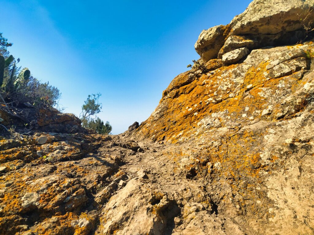
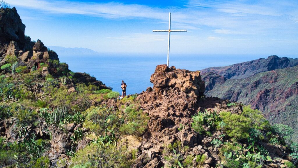
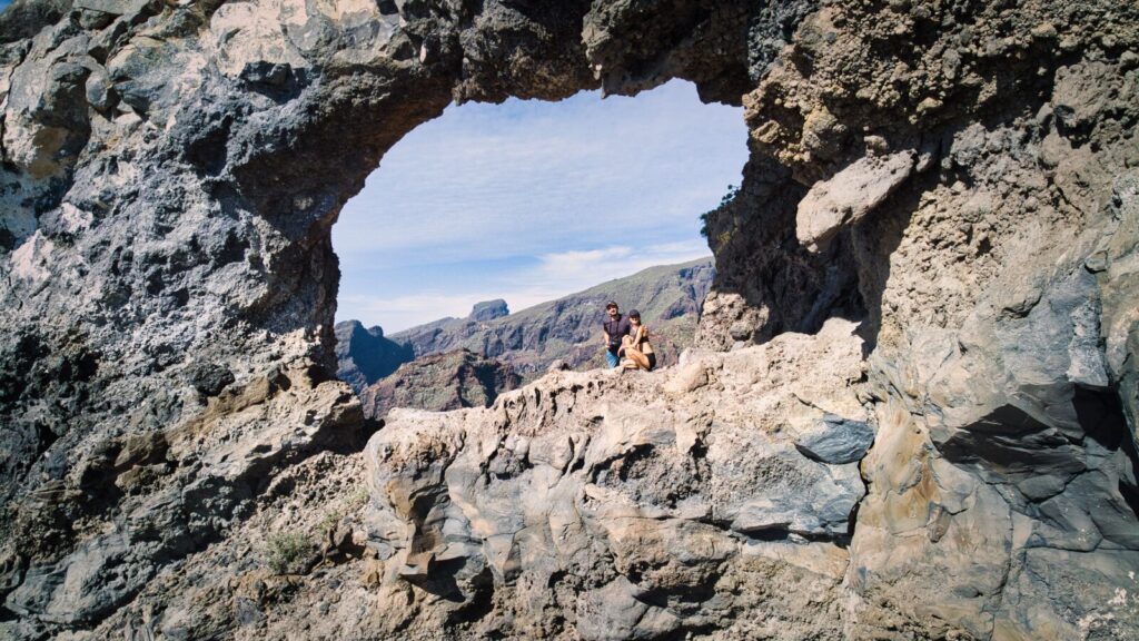
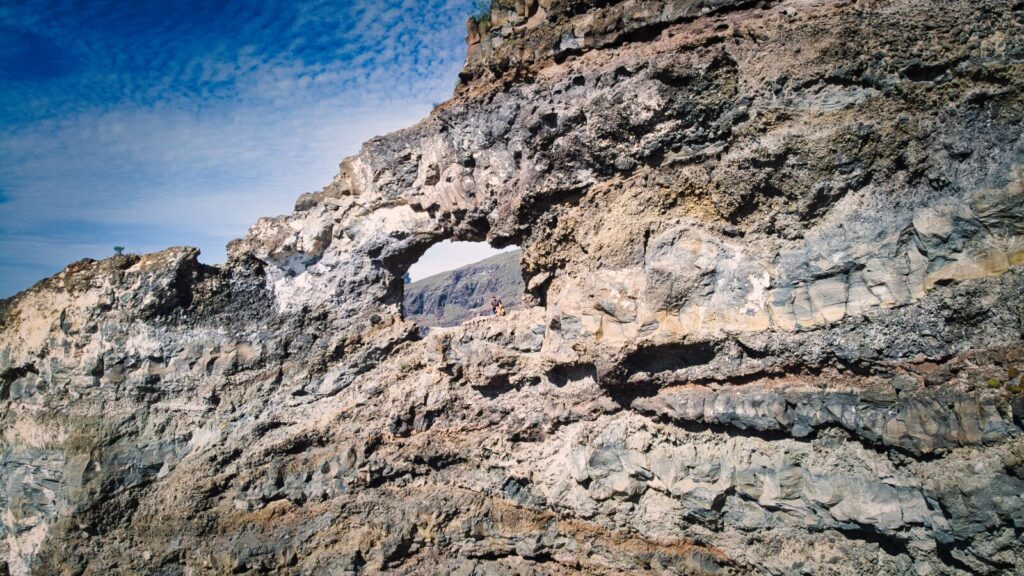
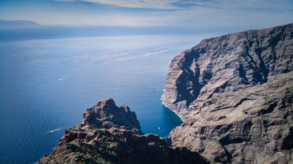
Tenerife Hiking Trail #9: El Agujero (The Hole)
The El Agujero trail proved to be one of the most unique but demanding places on the island. The 5.81 km route offered not only a physical challenge but also unforgettable views. Beautiful weather that accompanied us during the hike significantly contributed to our comfort and allowed us to enjoy excellent visibility.
Trail Characteristics:
- Distance: 5.81 km
- Difficulty: Difficult – requires experience
- Special feature: Natural rock arch with panoramic views
- Terrain: Narrow traverses above precipices
This trail, recognized as difficult, fully deserves such an assessment. The route led through narrow traverses located above abysses, requiring not only good physical condition but also courage and concentration.
The second part of the trail (before “the hole”) proved less obvious — poorly marked, leading through places where the path was crumbling and uncertain. Access to the arch itself was difficult, requiring great concentration and absence of height fear. We don’t recommend this for “casual” hikers!
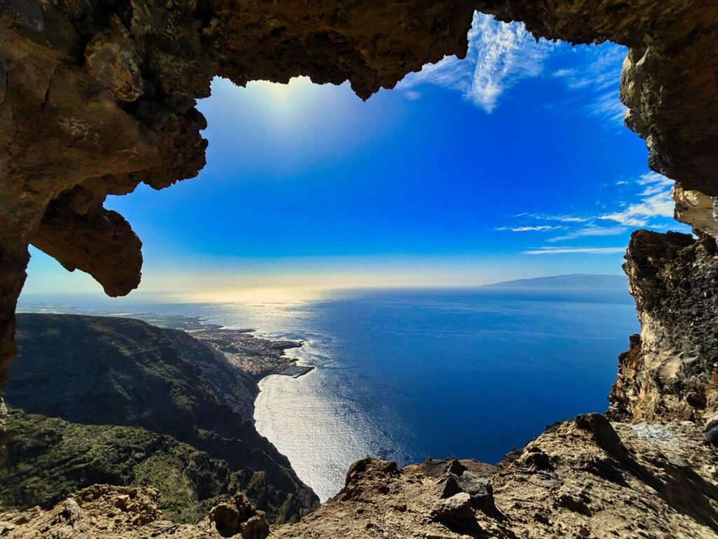
Particularly memorable is the view from “the hole” — a natural rock arch from which a breathtaking panorama stretches over Los Gigantes and the surrounding majestic cliffs.
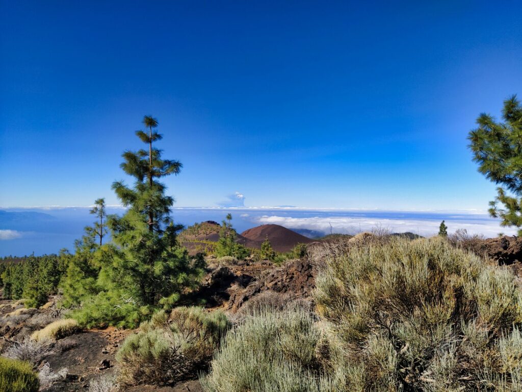
Tenerife Hiking Trail #10: Mirador de Samara
The “Mirador de Samara” loop in Teide National Park stretches over 5 km at an altitude above 2,000 meters. We can confidently say this hiking trail literally takes place in the clouds. It’s a fascinating route because, in addition to the white blanket of clouds at our feet, we also had black volcanic ground beneath us.
Trail Features:
- Distance: 5+ km loop
- Elevation: Over 2,000 meters
- Unique experience: Walking through and above clouds
- Setting: Teide National Park
Did you know? From Mirador de Samara, you can witness the “sea of clouds” phenomenon that settles over the Orotava Valley, creating one of Tenerife’s most magical natural spectacles.
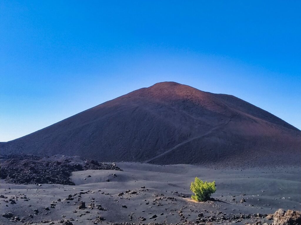
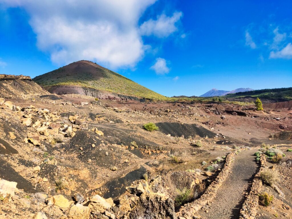
Tenerife Hiking Trail #11: Montaña Negra (Black Mountain)
Montaña Negra is a volcano located on Tenerife whose last eruption occurred in 1706, partially destroying the town of Garachico. The cone measures 140 meters, with its peak reaching 1,398 meters above sea level.
Starting from the town of Las Manchas, you can circle the cone via a moderately difficult route covering just under 8 km. The dominant brown color (not black as the name suggests) results from oxidation and makes this volcano stand out from neighboring Chinyero.
Trail Details:
- Distance: Under 8 km circuit
- Difficulty: Moderate
- Historical significance: 1706 eruption that affected Garachico
- Distinctive feature: Brown oxidized volcanic surfaces
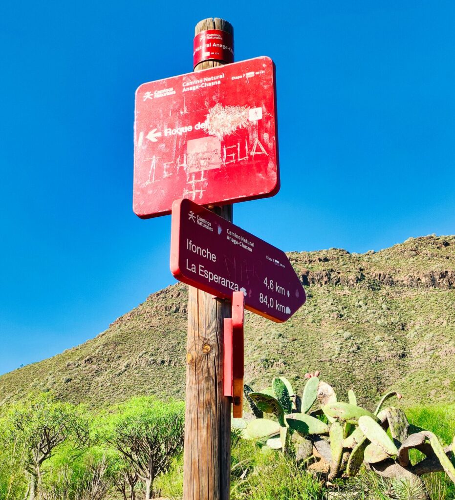
Tenerife Hiking Trail #12: Erjos – Charcas de Erjos
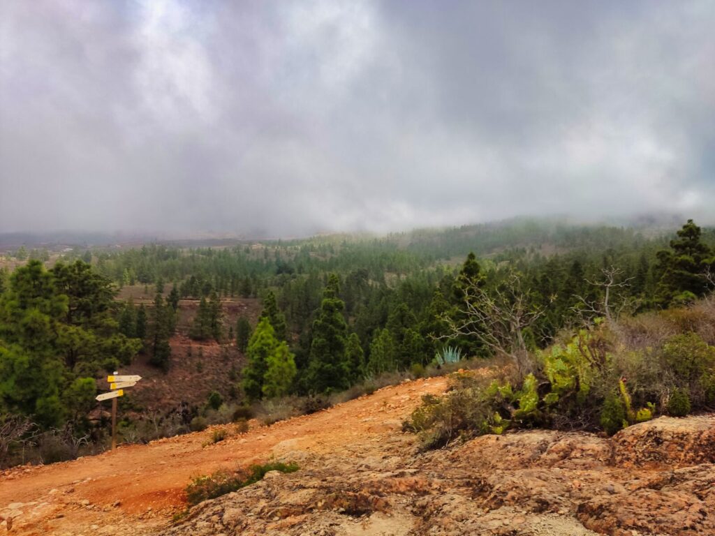
The Erjos – Charcas de Erjos route covers 5 km through very diverse landscape. The hiking trail begins on the outskirts of the small town of Erjos, initially leading between fields and meadows of local farmers. Then, climbing gently upward, you enter sparse forest before reaching the highest point and walking along the ridge with panoramic landscapes — glimpsing Teide on the right, the Teno range on the left, and the ocean ahead.
Trail Highlights:
- Distance: 5 km
- Terrain: Rural farmland to mountain ridges
- Views: Teide, Teno Peninsula, and ocean panoramas
- Special feature: Seasonal lakes (charcas)
Did you know? Charcas de Erjos are seasonal lakes that appear and disappear depending on rainfall, creating a unique ecosystem that attracts diverse bird species throughout the year.
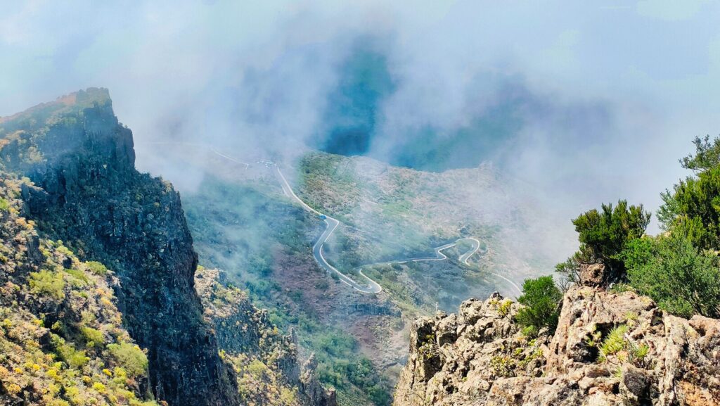
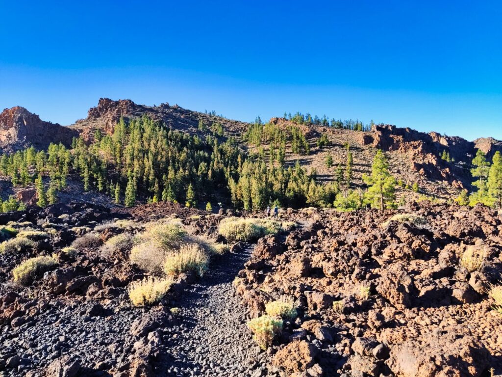
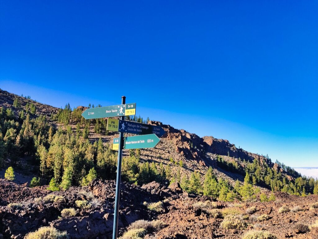
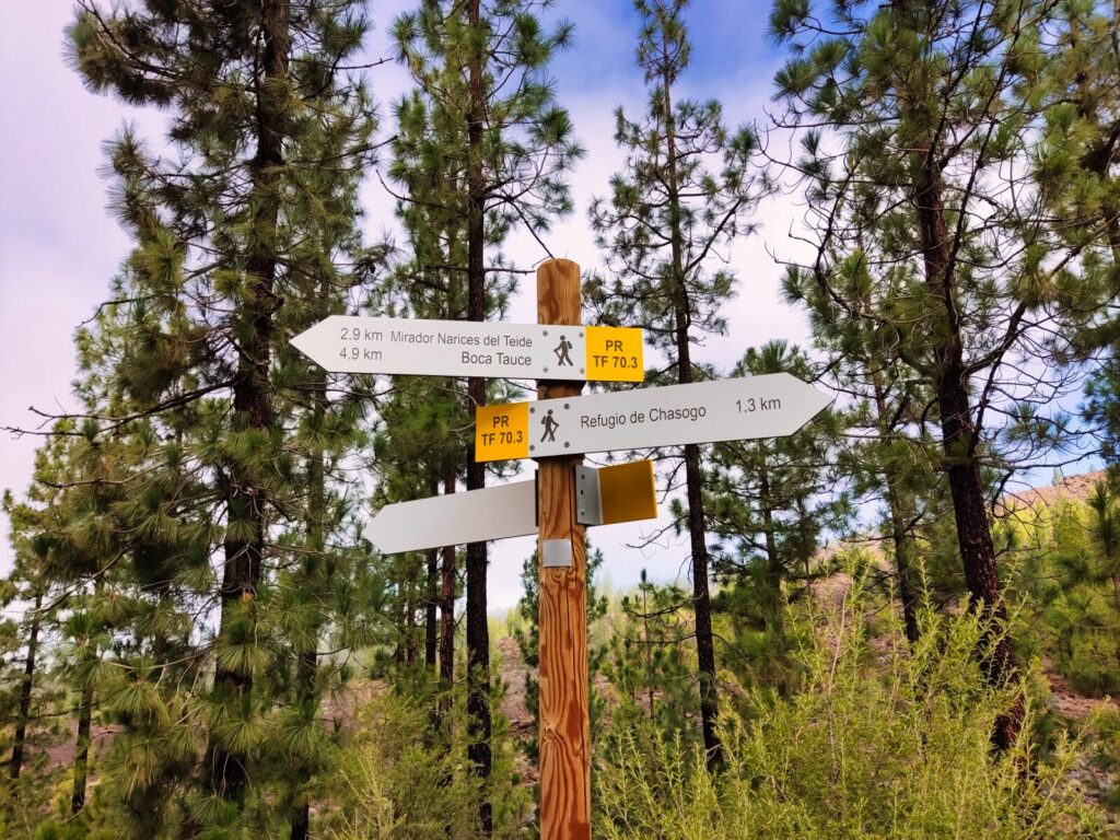
Tenerife Hiking Trail #13: Mirador Narices del Teide – Refugio de Chasogo
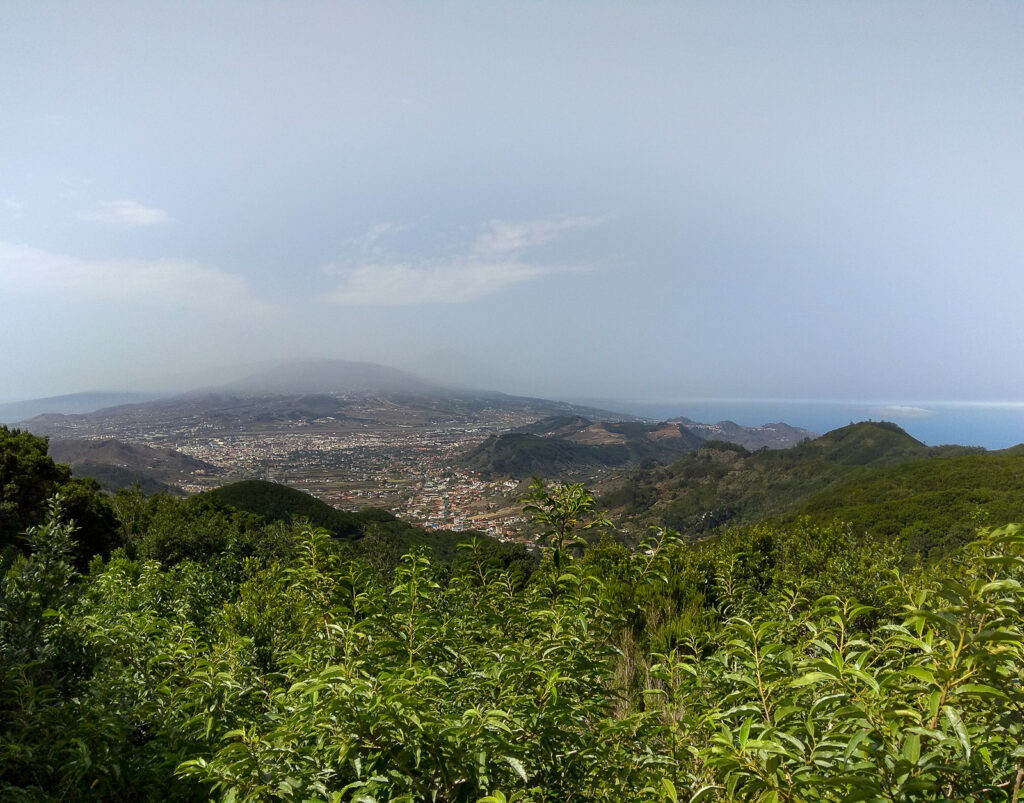
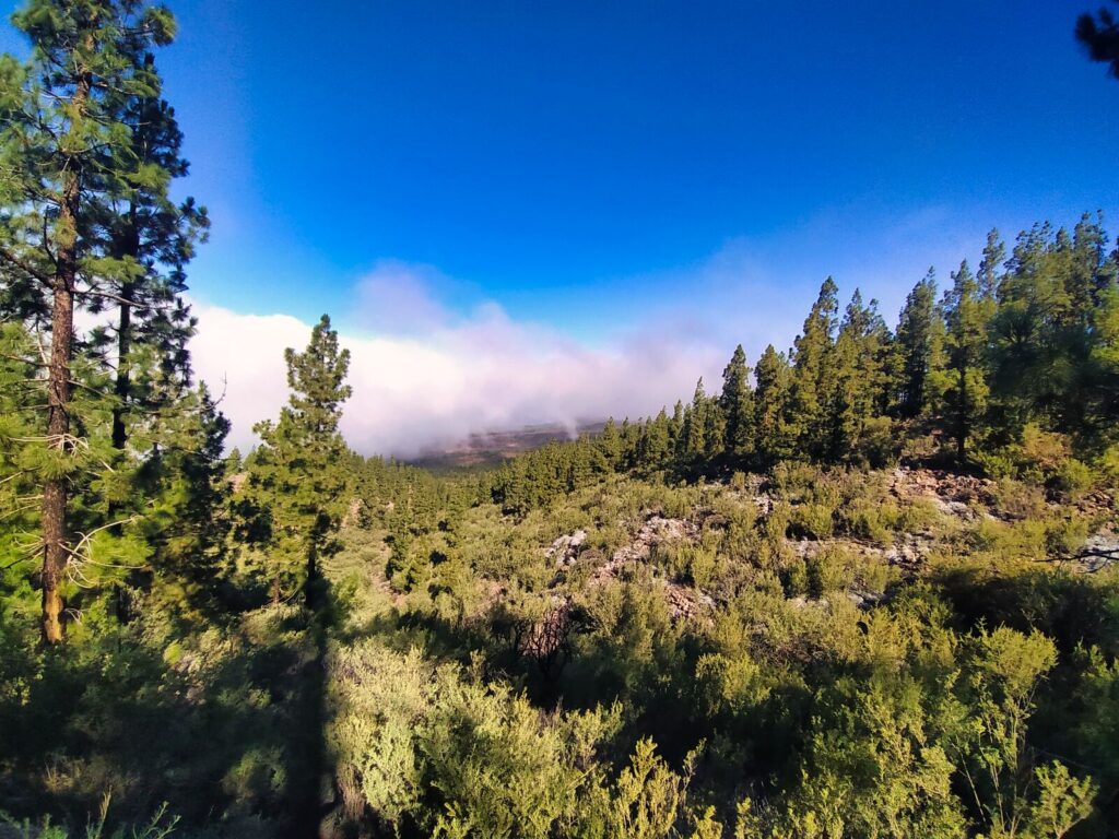
This undemanding and pleasant Tenerife hiking trail measures 4.1 km. It begins at the Mirador Narices del Teide viewpoint, initially leading through volcanic landscape with diverse forms left by cooling lava. A few hundred meters further, the path becomes varied with pine trees.
Lower down, it becomes decidedly greener, dominated by Canarian vegetation that also carpets the Charaguache ravine passed on the right. In appropriate weather, you can cover most of the trail literally walking through clouds. Moving cloud formations within arm’s reach prove to be a huge attraction for children.
Trail Features:
- Distance: 4.1 km
- Difficulty: Easy
- End point: Chasogo mountain refuge
- Family-friendly: Excellent for children who love clouds
The trail ends at the Chasogo mountain refuge, next to which is a helicopter landing pad. This isn’t a loop trail, so you need to return via the same route or arrange alternative transport from the TF-38 road.
Tenerife Hiking Trail #14: El Pijaral (Enchanted Forest) – PERMIT REQUIRED
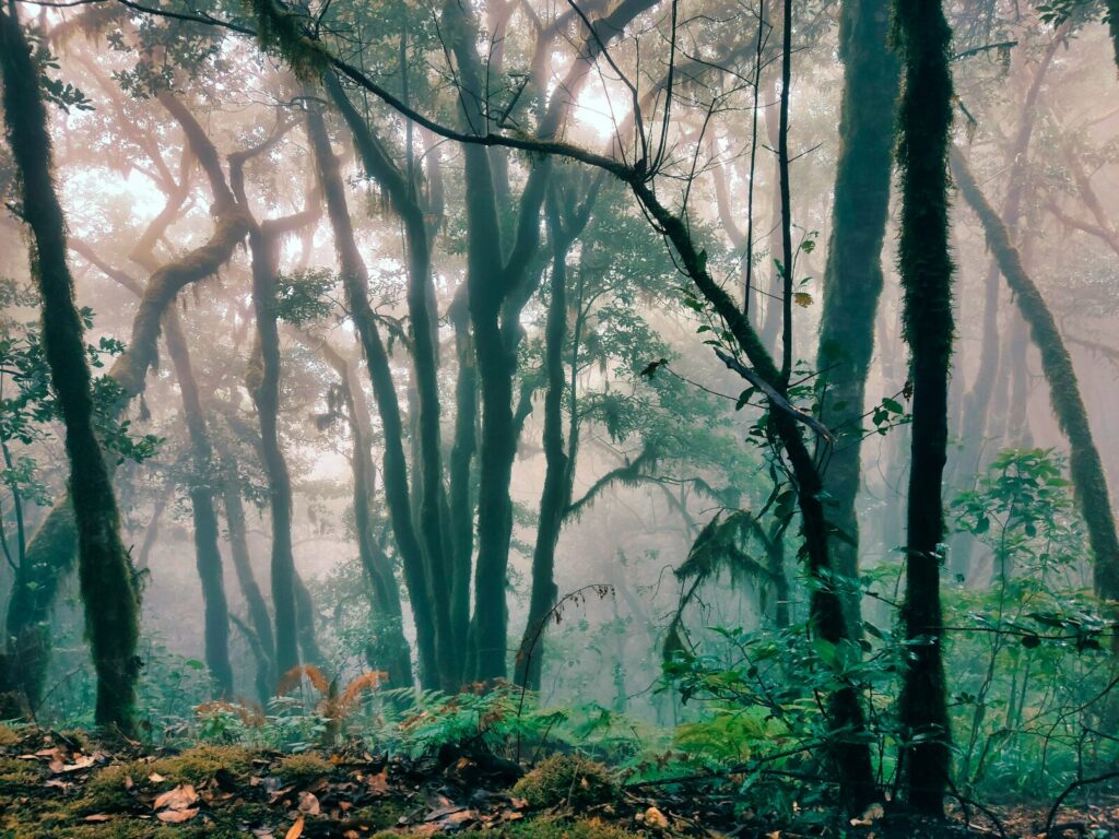
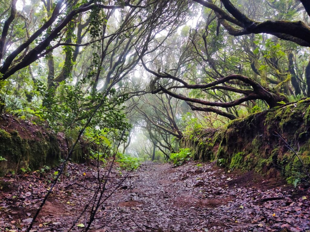
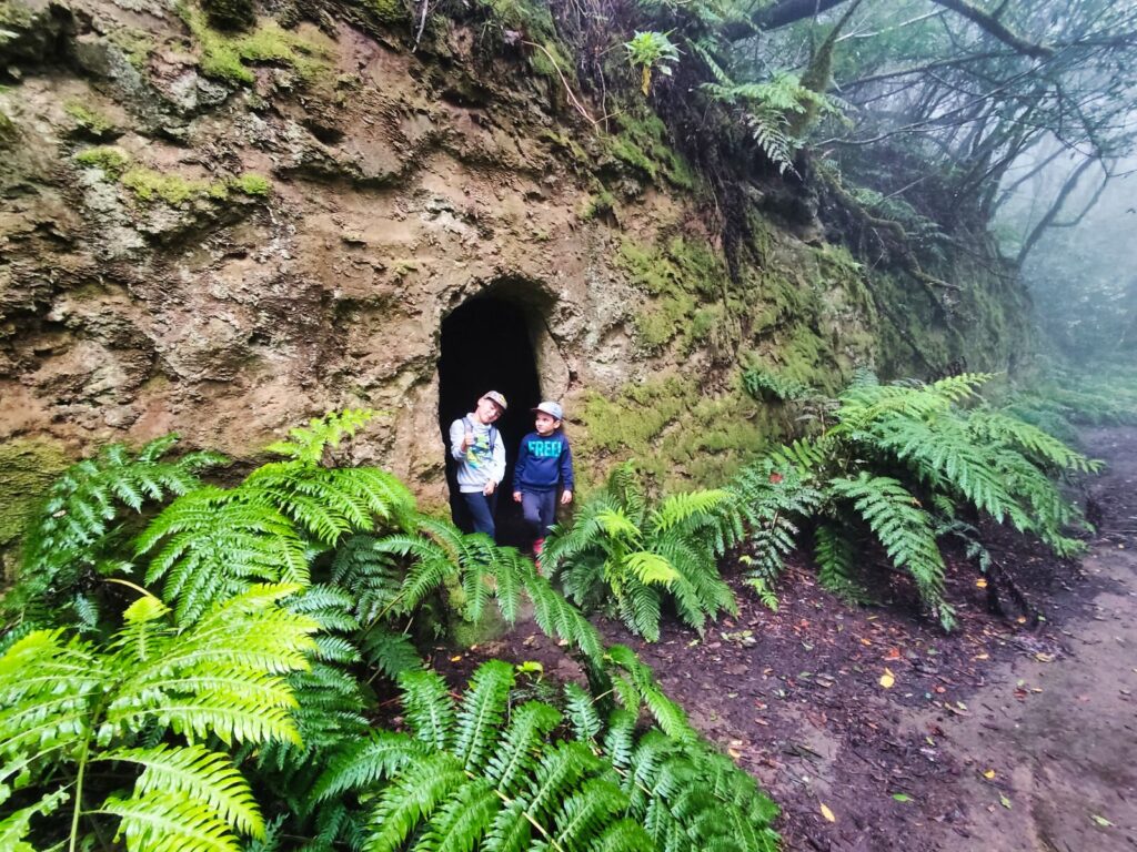
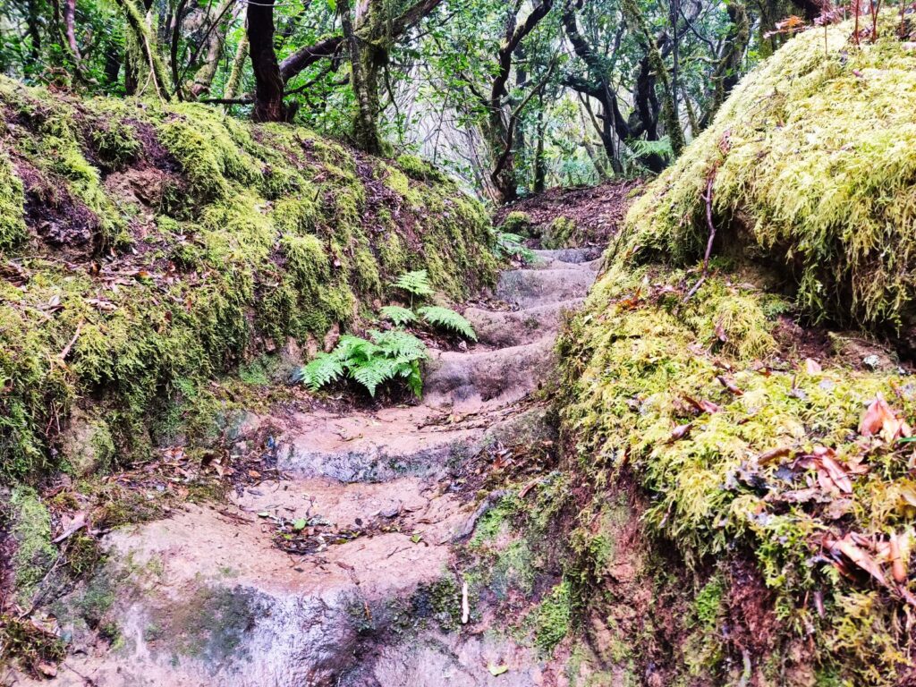
Anaga’s pristine corners, including El Bosque Encantado and Reserva del Pijaral, create a fairytale realm where goblins, hobbits, and trolls would feel right at home.
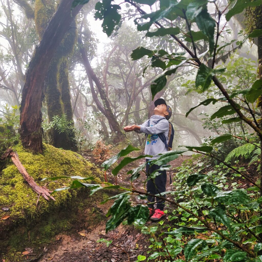
Shrouded in mists, winds, and clouds brought by trade winds, Anaga’s enchanted forest represents Tenerife’s most unique feature. Giant ferns creating carpets under our feet, moss-covered trees, and the canopy branches of laurel forest offer just a taste of this extraordinary part of the island.
Access Requirements:
- Advance reservation required (free but limited)
- Distance: 6.7 km
- Booking: https://centralreservas.tenerife.es/actividad/1
- Capacity: 45 spots released 16 days in advance
Important notes:
- Reservations typically release at 8:00 AM (winter) or 7:00 AM (summer)
- Print confirmation or save on phone for potential inspections
- Maximum 5 people per reservation
- Organized tours not permitted
Did you know? El Pijaral is called the “Enchanted Forest” because the interplay of mist, ancient laurel trees, and moss-covered surfaces creates an otherworldly atmosphere that feels like stepping into a fantasy novel.
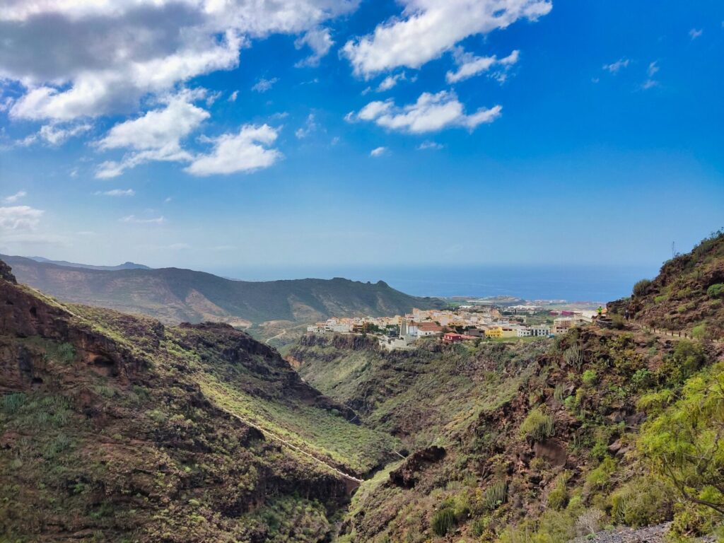
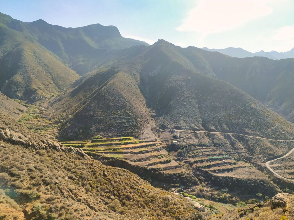
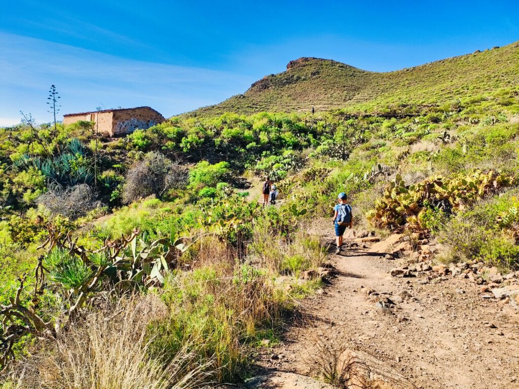
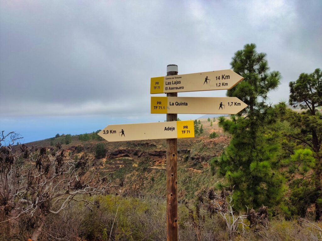
Tenerife Hiking Trail #15: La Quinta – Boca del Paso
This short (1.7 km one way) and easy walk rewards you with spectacular views over most of the Adeje coastline. Clear signage at the road intersection by the church in La Quinta indicates the direction to follow. Cars can easily be parked at the “tourist” parking area right at the trail entrance, surrounded by prickly pear cacti.
The clearly marked trail proves very easy to traverse. Along the way, you’ll pass traces of former agricultural activity — old cultivation terraces and remains of former peasant dwellings. You can also see chestnut trees, which provides another attraction for children.
Trail Details:
- Distance: 1.7 km one way
- Difficulty: Easy – perfect for families
- Historical features: Ancient agricultural terraces
- Views: Spectacular Adeje coastline panoramas
Did you know? This trail passes remains of ancient cultivation terraces used by the Guanches, Tenerife’s original inhabitants, showcasing traditional agricultural methods that sustained communities for centuries.
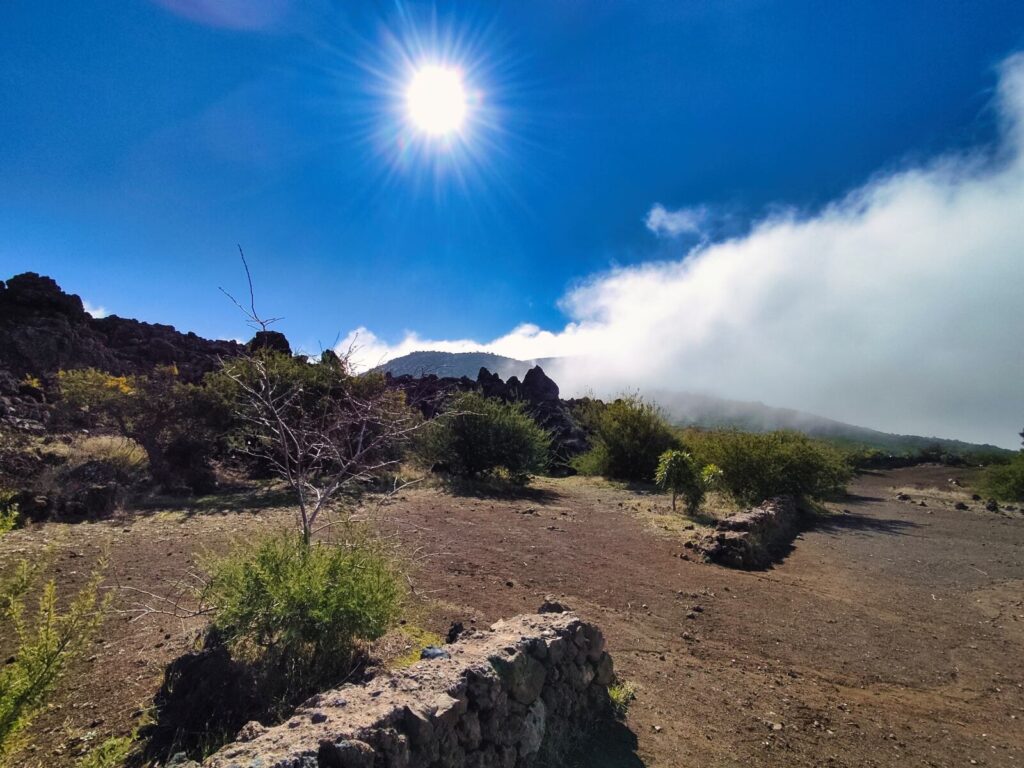
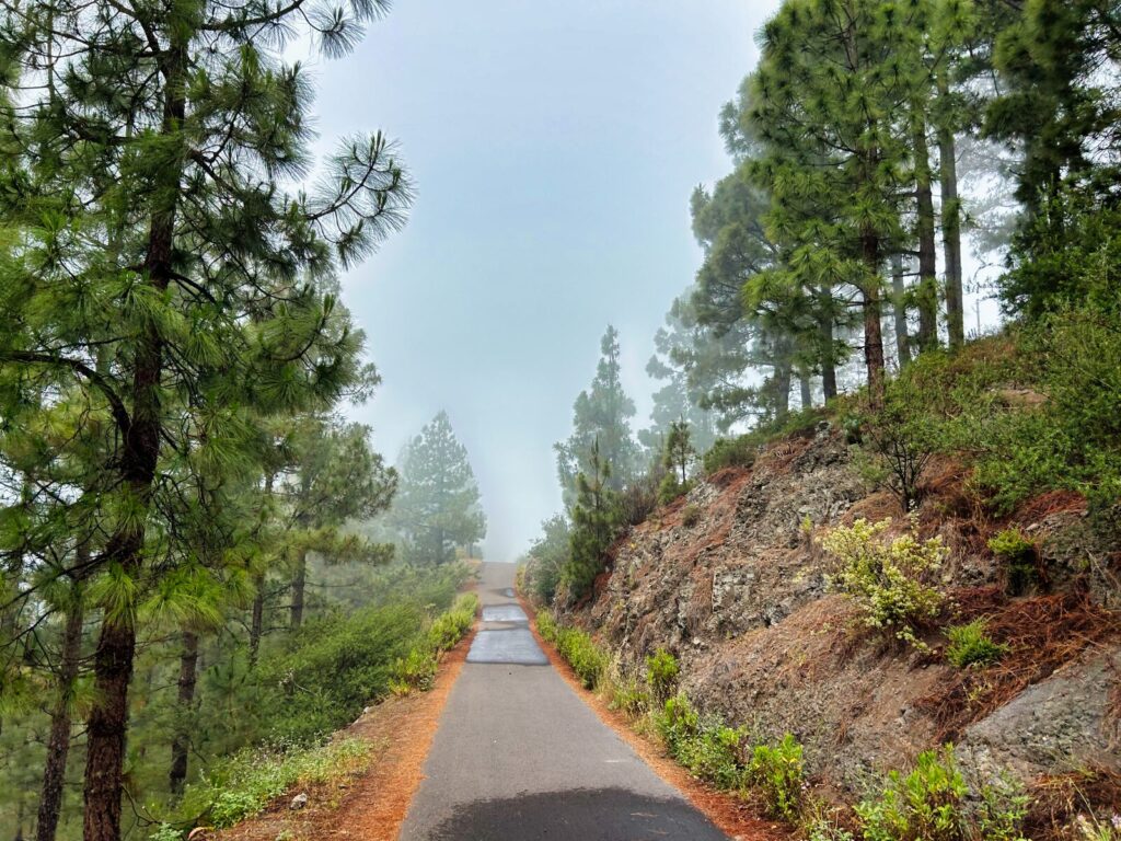
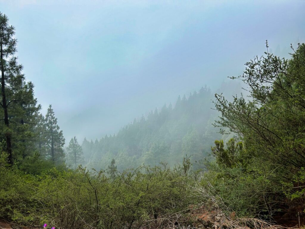
Tenerife Mountains and Climate Considerations
Hiking in the Canary Islands, particularly on Tenerife, offers unique advantages due to the island’s diverse microclimates. The Tenerife mountains create distinct weather patterns that can change dramatically with elevation and location.
Best seasons for Tenerife hiking:
- Winter (November-March): Perfect temperatures in lower elevations, possible snow on Teide
- Spring (April-May): Ideal conditions throughout the island
- Summer (June-September): Early morning starts recommended for higher elevations
- Autumn (October-November): Excellent weather with fewer crowds
Essential Tips for Hiking Tenerife
Where to Stay in Tenerife for Hiking
Where to stay in Tenerife for hiking depends on your preferred trail types:
For Anaga trails: Stay in the north (Puerto de la Cruz, La Laguna area)
For Teide National Park: Central locations provide best access
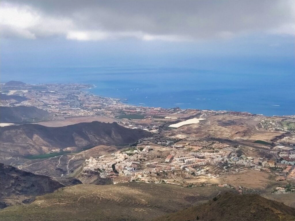
For southern trails: Los Cristianos apartments provide excellent base camps, as does nearby Adej
For variety: Choose accommodations with good road access to different regions
Trail Permits and Reservations – TRAILS REQUIRING PERMITS IN TENERIFE
Several hiking trails in Tenerife require advance permits:
1. TEIDE NATIONAL PARK TRAILS – Free trails requiring permits in Tenerife
- 1. Sendero PNT 10 Telesforo Bravo (Teide Summit Trail)
- 2. Sendero PNT 07 Montaña Blanca – La Rambleta
- 3. Sendero PNT 23 Los Regatones Negros
- 4. Sendero PNT 09 Teide – Pico Viejo
- 5. Sendero PNT 28 Chafarí
2. REGIONAL PARK TRAILS – Free trails with permits in Tenerife
- 1. Cabezo de Tejo – La Ensillada, known as El Pijaral (Anaga)
- 2. Monte Aguirre (La Asomada – Cruz de Afur)
3. TRAILS REQUIRING PAID TICKETS – Paid trails in Tenerife
- 1. Barranco del Infierno (Hell’s Ravine)
- 2. Barranco de Masca – Masca Ravine Trail
Booking tip: Permits often release at specific times (usually 8:00 AM, 16 days in advance), so plan accordingly.
Safety Considerations
- Always check weather conditions, especially for mountain hiking
- Carry sufficient water (more than you think you’ll need)
- Inform someone of your hiking plans
- Download offline maps before starting
- Respect trail restrictions and environmental guidelines
- Why Tenerife is a Hiker's Paradise
- Best Hikes in Tenerife: Complete Trail Guide
- Tenerife Hiking Trail #1: Roque de Taborno
- Tenerife Hiking Trail #2: Sendero de los Sentidos (Trail of the Senses)
- Tenerife Hiking Trail #3: Barranco del Infierno (Hell's Ravine)
- Tenerife Hiking Trail #4: Mirador de San Pedro – Ruinas de Gordejuela (Rambla de Castro)
- Tenerife Hiking Trail #5: Loop Around Chinyero Volcano
- Tenerife Hiking Trail #6: Roques de García
- Tenerife Hiking Trail #7: Benjo – El Draguillo Circuit
- Tenerife Hiking Trail #8: Roque del Conde
- Tenerife Hiking Trail #9: El Agujero (The Hole)
- Tenerife Hiking Trail #10: Mirador de Samara
- Tenerife Hiking Trail #11: Montaña Negra (Black Mountain)
- Tenerife Hiking Trail #12: Erjos – Charcas de Erjos
- Tenerife Hiking Trail #13: Mirador Narices del Teide – Refugio de Chasogo
- Tenerife Hiking Trail #14: El Pijaral (Enchanted Forest) – PERMIT REQUIRED
- Tenerife Hiking Trail #15: La Quinta – Boca del Paso
- Tenerife Mountains and Climate Considerations
- Essential Tips for Hiking Tenerife
- Your Complete Tenerife Hiking Adventure Awaits
- Frequently Asked Questions
- Rent our home
- Rent our home
Your Complete Tenerife Hiking Adventure Awaits
These 15+ hiking trails in Tenerife showcase the island’s incredible geological diversity — volcanic landscapes, ancient laurel forests, dramatic coastlines, and high-altitude desert environments all within a relatively small area. This makes hiking in Tenerife a unique experience where you can encounter multiple ecosystems in a single day.
Whether you’re seeking gentle walks in Tenerife suitable for the whole family or challenging trekking in Tenerife that pushes your limits, this volcanic island delivers unforgettable experiences. The combination of year-round hiking weather, diverse terrain, and well-maintained trail systems makes Tenerife one of Europe’s premier hiking destinations.
Ready to explore? Each of these Tenerife hikes tells a different story of volcanic formation, endemic flora, and the island’s rich cultural history. From the mystical waterfalls in Tenerife hidden in ancient ravines to the otherworldly experience of walking above clouds in the Tenerife mountains, these trails offer adventures that will redefine your understanding of what hiking can be.
Pack your hiking boots, bring plenty of water, and prepare for the adventure of a lifetime exploring these incredible best hikes in Tenerife.
Frequently Asked Questions
For those new to hiking in Tenerife, we recommend starting with Sendero de los Sentidos, La Quinta – Boca del Paso, or the coastal sections of Rambla de Castro. These walks in Tenerife offer spectacular views without requiring advanced hiking experience. Most are under 5km and suitable for families with children.
Several Tenerife hiking trails require advance permits. Free permits are needed for El Pijaral in Anaga and five trails in Teide National Park (including the Teide summit). Paid access is required for Barranco del Infierno and Masca Ravine. Book permits 16 days in advance through the official reservation systems to secure your spot.
Tenerife hiking is excellent year-round, but spring (April-May) and autumn (October-November) offer ideal conditions. Winter provides perfect temperatures for lower elevation walks in Tenerife, while summer requires early morning starts for hiking in the Canary Islands high-altitude trails. The Tenerife mountains can experience snow in winter above 2,000 meters.
Where to stay in Tenerife for hiking depends on your preferred trails. For Anaga forest hikes, choose the north (Puerto de la Cruz area). For Teide National Park access, central locations work best. Southern accommodations suit coastal hiking trails Tenerife offers. We recommend staying near the TF-1 highway for easy access to diverse best hikes in Tenerife.
Yes! The most spectacular waterfall in Tenerife is found at the end of Barranco del Infierno trail – a 200-meter cascade that’s particularly impressive after winter rains. While waterfalls in Tenerife aren’t as common as in other destinations due to the volcanic landscape, several hidden cascades can be discovered through trekking in Tenerife, especially in the humid Anaga region during rainy seasons.
Planning your Tenerife hiking adventure? Remember that weather conditions can change rapidly, especially in the mountains. Always check current trail conditions and weather forecasts before setting out on any of these incredible hiking trails in Tenerife. Some trails require advance permits, so plan accordingly for the full range of experiences these 15+ epic routes provide.