Deep Atlantic Low Puts Canary Islands on Alert
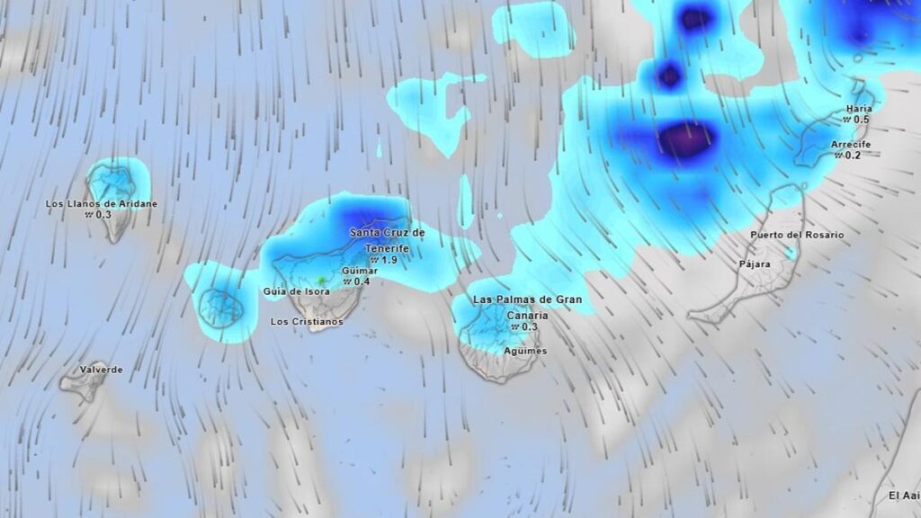
The atmosphere is stirring once more over the Atlantic, and the Canary Islands are looking northwest with caution. A new, deep area of low pressure, still developing in the North Atlantic, could direct a portion of its instability towards the archipelago. The State Meteorological Agency (Aemet) is maintaining active surveillance for a potential onset of intense winds, a notable increase in swell, and a progressive drop in temperatures. This is especially true for Tenerife, where the impact could be felt most strongly in areas exposed to the north and northeast.
Although its final trajectory is not yet fully defined, weather models suggest the system could graze the Canaries, sending bands of cloud, strengthening winds, and significant rough seas. Meteorological services insist the situation “can change rapidly” and urge the public to follow official updates. For Thursday, the first rains will concentrate on the archipelago with yellow coastal and wind warnings in place. The initial symptoms may be felt on the north and northeast coasts, as well as on mountain peaks and mid-altitude slopes facing the wind.
Expected Impacts from the Approaching Storm
The deep low could bring the following conditions: Strong winds, with occasional gusts potentially exceeding 70–80 km/h in high areas and channels between islands. Increasing swell, with a northwesterly ground swell that could build to between 3 and 5 metres at the peak of the episode. A drop in temperatures, more pronounced in interior and mid-altitude zones. Increased cloud cover, especially over Tenerife, La Palma, La Gomera and El Hierro. Occasional rainfall, most likely on northern slopes and highland areas.
Detailed Island-by-Island Forecast
Below is a detailed forecast based on the storm’s predicted evolution and the typical atmospheric configurations for this type of episode.
Tenerife
North and Northeast: A progressive increase in thick cloud. Weak and occasional rain, more consistent in mid-altitude areas. Moderate to strong northeasterly wind, with intense gusts in exposed areas. A moderate thermal drop. Very rough seas, with waves of 3 to 4 metres on open coasts.
South and Southwest: Cloudy intervals, with skies clearing in the morning. Wind increasing in the afternoon. Slightly lower temperatures.
Peaks: Intense northerly wind. Possibility of dense fog. Very low wind chill.
Gran Canaria
Increased cloud in the north, with weak rainfall. Moderate northeasterly wind, with strong gusts in the southeast and northwest. Rough seas on the north coast.
Lanzarote and Fuerteventura
Cloudy intervals, thicker in interior zones. Northeasterly wind with gusts that could exceed 60 km/h. Rough seas in areas open to the north and northeast.
La Palma
Cloudy in the north and east, with scattered showers. Moderate to strong wind on peaks and the far northeast. Notable swell along the northern fringe.
La Gomera
Cloudy intervals, increasing in the afternoon. Moderate northeasterly wind, with strong gusts in the east and northwest. Significant ground swell approaching the island.
El Hierro
Skies more overcast in the north, with some weak rain. Northeasterly wind with periods of strong intensity. Waves may reach around 3–4 metres by the end of the day.

No post found!